
Wind Warnings for Wreckhouse Tonight and Northern Newfoundland Saturday
Our next storm is moving in, and Environment Canada has issued two wind warnings for Newfoundland: a Wreckhouse wind warning for tonight, and a wind warning for northern and northeastern Newfoundland for Saturday afternoon and early evening. Here’s what you need to know.
Wreckhouse wind warning: tonight
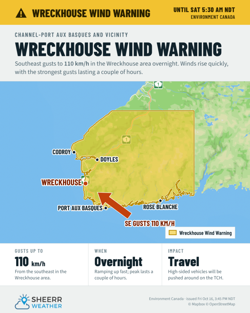
A Wreckhouse wind warning is in effect for Channel-Port aux Basques and vicinity. Damaging winds are expected overnight tonight, with maximum wind gusts of southeasterly 110 km/h in the Wreckhouse area.
Environment Canada says the winds are expected to increase rapidly tonight, but the period of strongest winds is only expected to last a couple of hours. High-sided vehicles will be pushed around by the wind, and disruptions to services and travel are possible, so secure loose objects.
If you’re travelling the Trans-Canada between Tompkins and Cape Ray tonight, or heading to or from the ferry in Port aux Basques, keep an eye on my Wreckhouse Wind Gauge. It shows the live wind and gusts from Environment Canada’s Wreckhouse station, updated every couple of minutes, along with a 24-hour wind forecast, the latest alerts, road information from 511NL and the highway cameras in the area. If you’re driving a high-sided vehicle or towing a trailer, it’s worth checking before you go.
Wind warning for northern and northeastern Newfoundland: Saturday
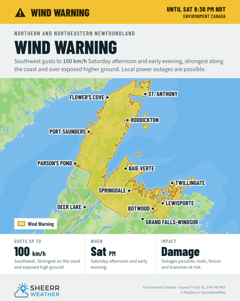
A wind warning is also in effect for northern and northeastern Newfoundland, covering:
- Bay of Exploits
- Green Bay – White Bay
- Northern Peninsula East
- Parson’s Pond – Hawke’s Bay
- Port Saunders and the Straits
Damaging winds are expected, with maximum wind gusts of southwesterly 100 km/h Saturday afternoon and early evening. The strongest winds are likely to occur along the coast or over exposed higher elevations.
Local utility outages are possible, and there could be damage to roofs, fences, branches or soft shelters. Take a few minutes before Saturday afternoon to secure loose objects like garbage bins, patio furniture and anything else that could take flight.
Snow for southeastern Labrador
While the Island deals with the wind, Environment Canada’s special weather statement continues for Eagle River, Cartwright to Black Tickle, Norman Bay to Lodge Bay, and Red Bay to L’Anse-au-Clair. The first notable snowfall of the season is expected Saturday, with 5 to 10 cm inland and over higher terrain. The snow is expected to be wet and heavy, and roads could become slippery and difficult to navigate.
I’ll keep you posted as these warnings are updated. You can always find every active alert for the Province on the Alerts page.
Don’t forget to…
📱 Get the Sheerr Weather App in the Apple App Store and Google Play Store.
💨 Check the Wreckhouse Wind Gauge for live winds through Wreckhouse.
🎥 Check out the Provincial Highway Cams to see 👀 what’s going on around our highways.