
Freezing Drizzle Advisory In Effect Until Thursday Morning From the Avalon to the Northern Peninsula and southeast Labrador
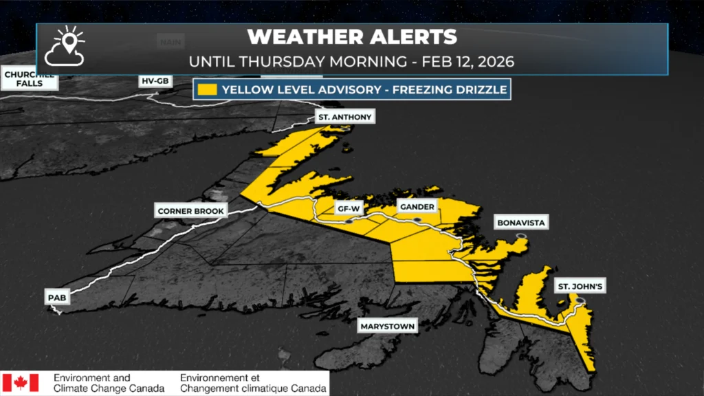
The highlighted areas are under a Yellow Level Advisory for Freezing Drizzle issued by Environment Canada until Thursday morning.
A YELLOW LEVEL ADVISORY FOR FREEZING DRIZZLE has been issued by Environment Canada and is in effect for the following areas until Thursday (February 12, 2026) morning:
Avalon Peninsula North
St. John’s and vicinity
Bonavista Peninsula
Clarenville and vicinity
Terra Nova
Northern Peninsula East
Port Saunders and the Straits
Grand Falls-Windsor and vicinity
Bay of Exploits
Bonavista North
Gander and vicinity
Green Bay – White Bay
During the daylight hours today, temperatures in some areas may rise above zero, allowing freezing drizzle to transition to drizzle or flurries.As the sun sets and temperatures drop this evening, freezing drizzle, at times mixed with light snow, will become more widespread and persist until Thursday morning.
Icy surfaces will likely form and could be difficult to detect.
Environment Canada issues Freezing Drizzle Advisories when drizzle is expected to freeze on contact and create icy surfaces.
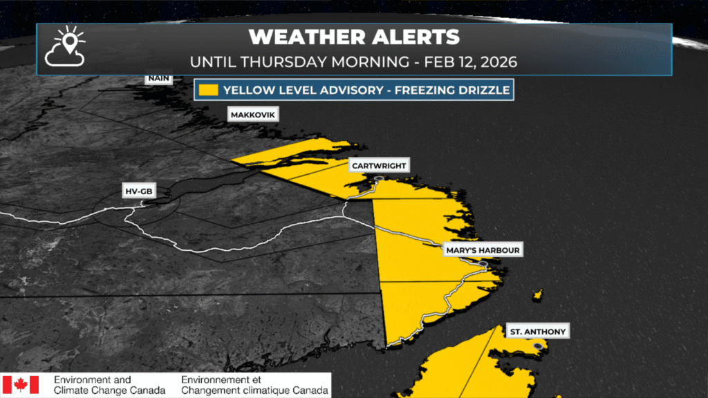
The highlighted areas are under a Yellow Level Advisory for Freezing Drizzle issued by Environment Canada until Thursday afternoon.
A YELLOW LEVEL ADVISORY FOR FREEZING DRIZZLE has been issued by Environment Canada and is in effect for the following areas in Labrador from tonight through Thursday (February 12, 2026):
Red Bay to L’anse-au-Clair
Norman Bay to Lodge Bay
Cartwright to Black Tickle
Rigolet and vicinity
Areas of freezing drizzle are expected tonight into Thursday.
The freezing drizzle will be most persistent over higher terrain. Precipitation will transition to snow over all areas Thursday afternoon or evening as a low-pressure system approaches the region. Icy surfaces will likely form and could be difficult to detect.
Freezing drizzle advisories are issued when drizzle is expected to freeze on contact and create icy surfaces.
Dont’ forget to check out:
📱 Get the Sheerr Weather App in the Apple App Store and Google Play Store.
🗺️ Check out the Map Room to see all the latest weather observations for the Province.
🎥 Check out the Provincial Highway Cams to see 👀 what’s going on around our highways and