
Friday Morning’s Weather Briefing — June 19, 2026
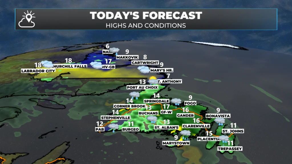
Good Friday morning! Here are today’s highlights:
Another area of low pressure moves in today and brings rain to most of the Island by this afternoon.
Wreckhouse Winds peak near 100 km/h at times from this morning into the afternoon.
Rain lingers into Saturday for most of Newfoundland.
The Avalon and eastern areas will see the nicest weather on the Island Saturday, with sunny breaks and a high near 20ºC. It may even feel muggy!
The weather improves Sunday as this low departs/
This morning’s update is sponsored by Roebothan, McKay, Marshall.

Visit MakeTheCall.ca today to learn more about how the law firm can help you!
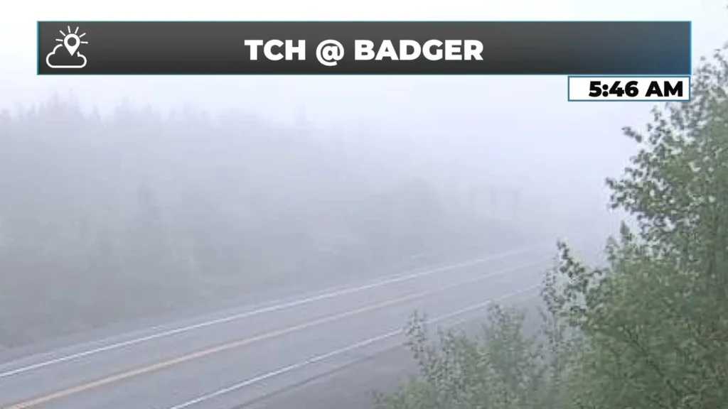
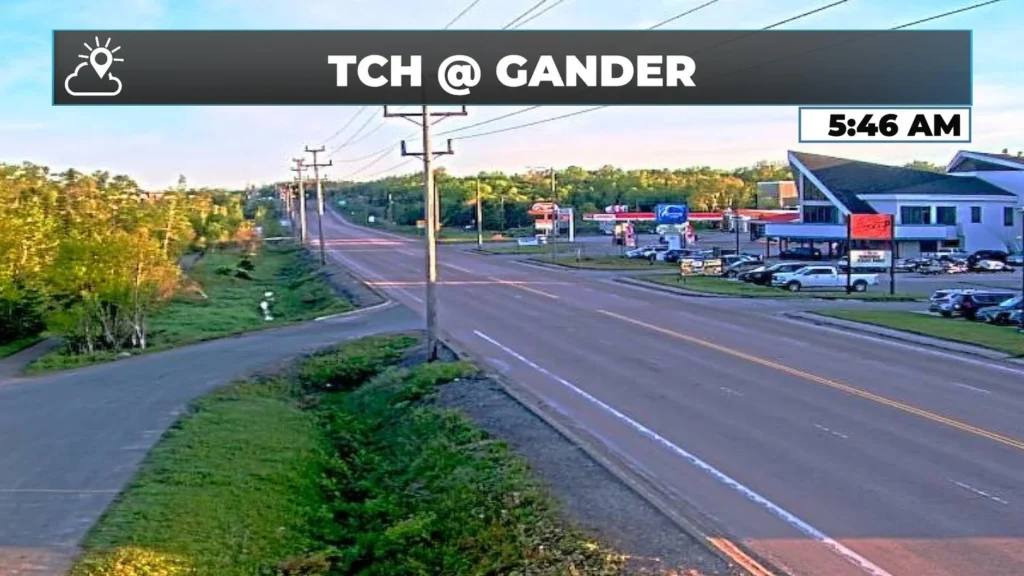
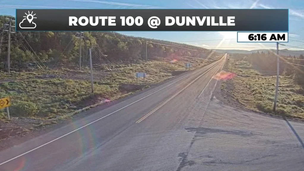
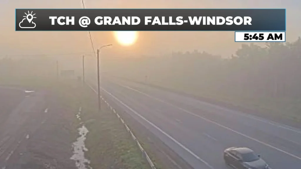
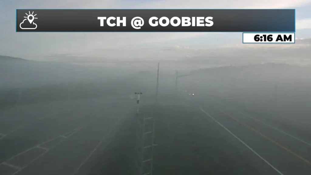
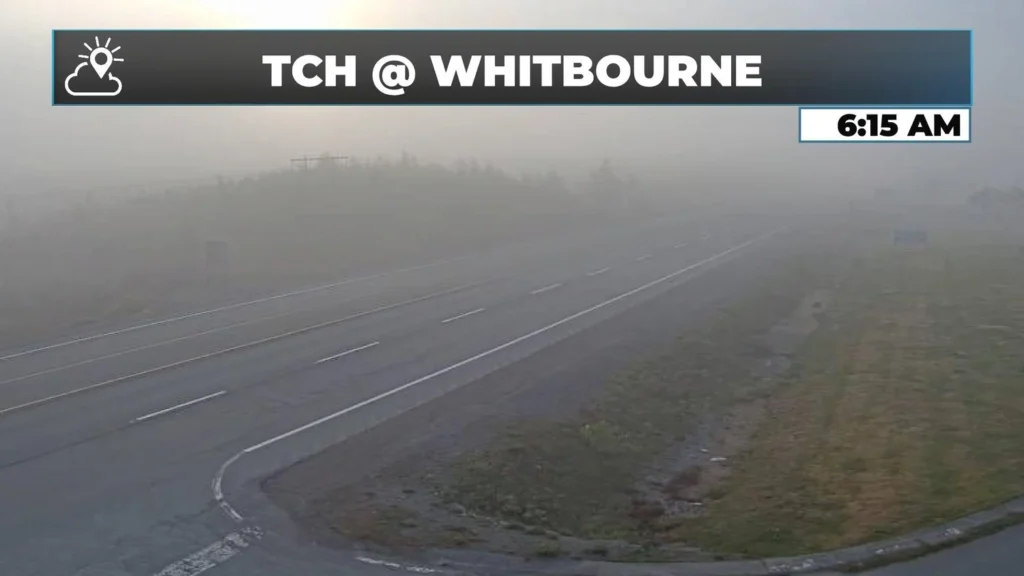
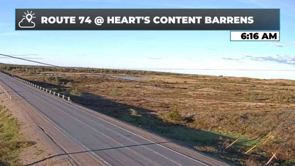
It’s a sunny start for parts of eastern and northeast Newfoundland, with hardly any clouds in the sky in some areas. In other areas in the east and in Central, we are seeing dense fog! The sun in the east may give you a false sense of security as our next weather-maker is moving in and has already arrived in the southwest.
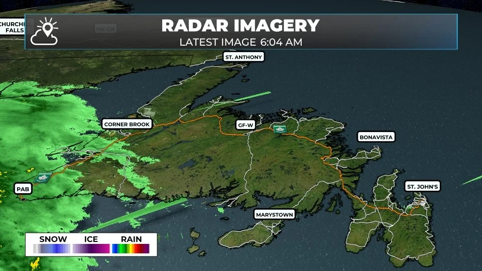
The next system on our doorstep this morning — and in parts of the province, it’s already here. A low-pressure system sitting over the Maritimes right now is pushing a broad swath of rain toward the Island through today and into tonight. Along the Southwest Coast, the wind has already made its presence known: Port aux Basques is reporting east winds of 35 km/h gusting to 53 as of early this morning, and the Wreckhouse area is expected to see gusts near 100 km/h through the mid-morning hours. A Wreckhouse Wind Warning is in effect for today. If you are driving the Trans-Canada between Port aux Basques and Bay St. George today, check road and weather conditions before you go. This is not a day to underestimate that stretch.
For the rest of the Island, this is mainly a rain event. The South Coast is going to take the brunt of it — up to 25 mm for the Burgeo area, the Connaigre Peninsula, and parts of the Burin Peninsula. Most other regions are looking at 5 to 15 mm, with rain persisting into the overnight hours and a bit of drizzle and fog lingering into Saturday morning on the Avalon. The system clears from west to east through Friday evening, and by the weekend, most of the province gets a break.
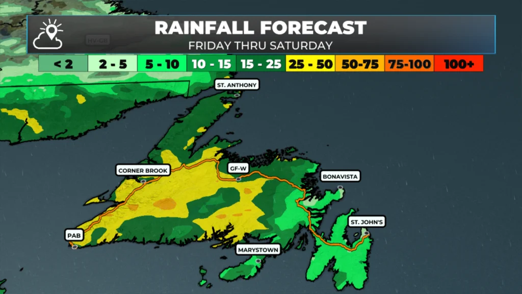
THE FORECAST(S)
The Avalon and Eastern Newfoundland: Sunshine this morning gives way to increasing clouds with rain arriving by afternoon, southeast winds picking up to around 25 km/h, and roughly 5 to 10 mm through the day. Highs reaceh 10ºC to 12ºC. Rain continues overnight with fog and drizzle into Saturday morning. Saturday is actually a decent surprise: a foggy morning burns off to clouds and a high near 19°C. There will be a few showers around.
Central — Gander, Grand Falls–Windsor, down the Northeast Coast: rain arrives by mid-morning and stays persistent through the day, around 14 mm in total. Highs reach 15°C near Gander, with temperatures approaching 20°C possible for sheltered inland spots. The Northeast Coast stays cooler and foggier throughout. A few lingering showers Saturday before things ease off.
The West Coast — this is a steady, heavier rain day. Both Corner Brook and Stephenville are looking at 15 to 20 mm today, rain right through the afternoon. Highs 14 to 15°C; the Humber Valley sits on the warmer end of that range, the Long Range Mountains and coastline on the cooler side. It stays a bit unsettled through Saturday too — another 5 to 10 mm possible — before Sunday dries out.
The South Coast — Burgeo is looking at over 20 mm today with east wind gusting to 40 km/h and a high of 11°C. If you are in this area, keep a close eye on local streams and low-lying areas. Saturday settles down with only scattered showers and a high of 12°C.
Southwest Coast — rain and wind all day, 15 to 20 mm by tonight, east winds averaging 45 km/h in town and peak Wreckhouse gusts are the main headline. High 12°C. Conditions improve Friday evening as the system moves northeast.
GNP and the Straits around St. Anthony: actually one of the quieter spots on the Island today — 7°C, afternoon showers, roughly 5 mm Friday. The main rain event arrives Saturday for the Northern Peninsula, up to 15. Fog likely through much of the weekend. Temperatures are holding in the 6ºC to 7°C range.
Labrador, the Big Land — For Lab City and Wabush, actually has one of the better days in the province, 18°C, mostly cloudy and mostly dry before showers arrive late in the evening. The Goose Bay area is similar at 16°C, with showers arriving overnight and Saturday morning. Saturday brings 5 to 10 mm and a fresh northeast wind to central Labrador. The North Coast around Nain is a different story: persistent northeast flow, fog, and temperatures only reaching 6°C. No significant rain, but cold and socked in through the weekend before things improve Sunday, when Lab West could again touch 18°C and Goose Bay sees afternoon sun.
My next update will be posted later today!
📱 Get the Sheerr Weather App in the Apple App Store and Google Play Store.
🗺️ Check out the Map Room to see all the latest weather observations for the Province.
🎥 Check out the Provincial Highway Cams to see 👀 what’s going on around our highways and
Good morning Eddie!Thanks for the update…
Good morning Eddie thanks for the update have a great weekend
Thanks for the update Eddie! Have a great weekend 😊