
Tuesday Morning’s Weather Briefing — September 15, 2026

Good Tuesday Morning! Here are today’s highlights
Rain showers will continune on the Avalon this morning before ending, but clouds hang tough, while the rest of NL sees the sun today.
Highs reach the upper teens to lower 20s across the board.
Rain may return to the Avalon late tonight into midday Wednesday from a feature located offshore.
Quiet weather hangs around for a couple of days before a cool down in Labrador that may bring the first flakes of the season to some areas.
A potent low could bring heavy rain and high winds to parts of Newfoundland Friday night into Saturday.
This morning’s update is sponsored by Roebothan, McKay, Marshall.

Visit MakeTheCall.ca today to learn more about how the law firm can help you!
Rain is still falling on the Avalon this morning, specifically over the eastern half. Radar imagery shows this quite nicely. The imagery also shows the rain band is moving to the east, and forecasts indicate it will be offshore within the next hour or two. That being said, as you or the kiddos head out the door for school on the Southern Shore and in the Metro area this morning, a rain jacket or umbrella may not be a bad choice.
Today brings that major improvement for most of the province, just like advertised — though the handoff from rain to sunshine will take a bit longer in the east, where clouds will hold tough through the day. Even with the clouds, highs under them still climb into the mid-to-upper teens. The rest of Newfoundland and Labrador through the day, with highs near 20°C for most areas. It’ll be a little breezy in some areas, especially on the south and southwest coast, where gusts will be as high as 50 km/h.
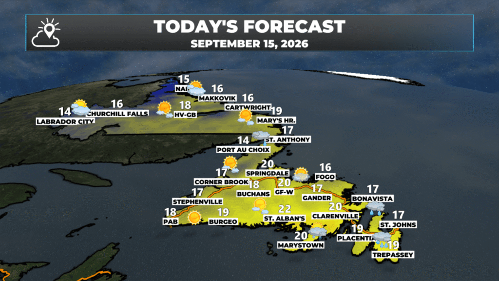
NL’s forecast for today (September 15, 2026).
The forecast for tomorrow looks similar to today for most areas of the Province. The exception will be on the Avalon where an area of rain looks to arrive during the pre-dawn hours and stick around through the morning. This little batch was forecast to remain offshore yesterday, but has shifted a bit northwest today. The same could happen with additioanl model runs later today and I’ll be sure to update you accordingly. Beyond that, the weather for the remainder of the work week looks good on the Island. In the Big Land, it will not be the same story…
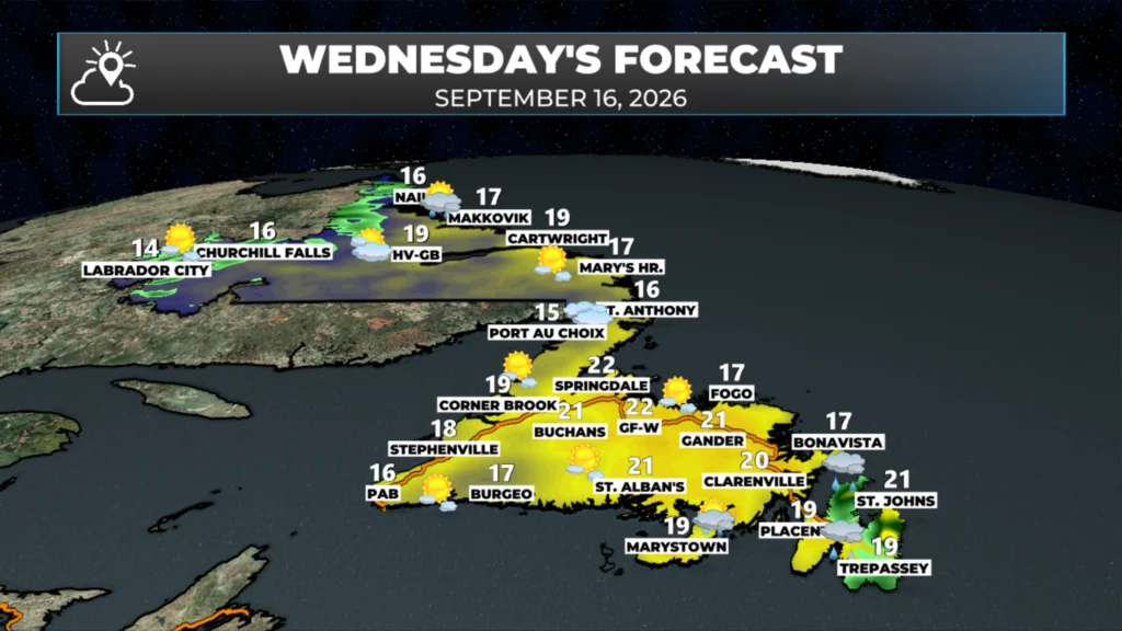
NL’s forecast for tomorrow (September 16, 2026).
A cool down arrives in Labrador to close the week, and the first flakes of the season may fall along parts of the coast and the west between Friday and Saturday around a developing area of low pressure. Amounts look minimal at this time.
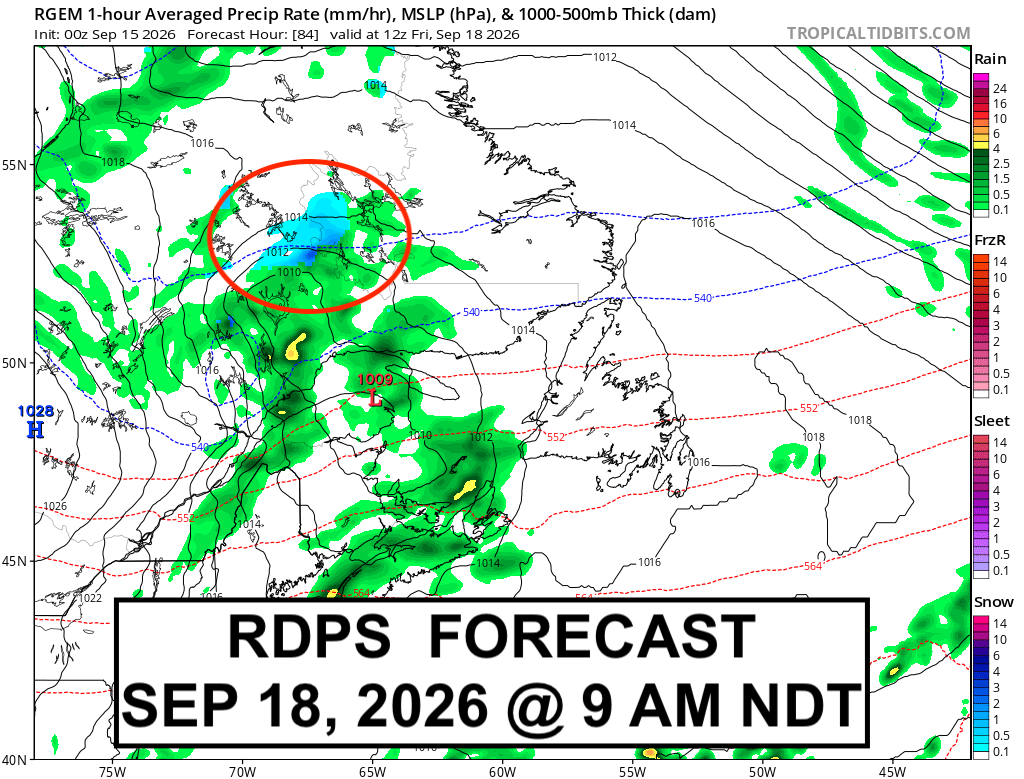
The same system driving the rain and wet snow in Labrador late this week looks to spawn a very potent low over or near central/northeast Newfoundland between late Friday and Saturday. Along with the potential for heavy rain to start the weekend, the threat of a period of high winds also exists. I’ll be watching this one closely over the next few days…

📱 Get the Sheerr Weather App in the Apple App Store and Google Play Store.
🗺️ Check out the Map Room to see all the latest weather observations for the Province.
🎥 Check out the Provincial Highway Cams to see 👀 what’s going on around our highways and
Thanks for weather update Eddie
Good Morning Eddie. Thanks for update, at least we still have warm temps.