
Tuesday Morning’s Weather Briefing — October 13, 2026
Good Tuesday Morning!
The low and cold front that brought Monday’s rain and wet snow are pulling away, and high pressure is building in behind them.
It’s a cool, breezy start, with temperatures near or below freezing in many areas this morning. Watch for frost and a few slick spots, especially on higher ground in the west.
Skies clear from west to east today, and most of the Province sees sunshine by the afternoon.
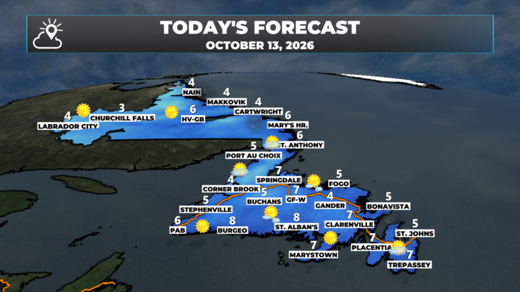
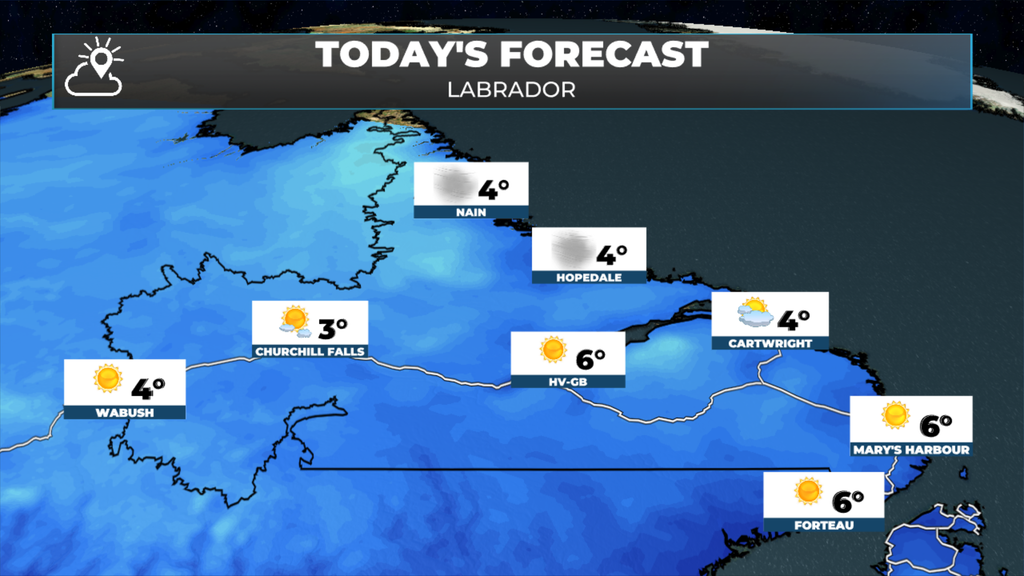
Highs are in the single digits across the board, generally 4 to 8 degrees.
Northwest winds stay brisk today, strongest along the northeast coast, then ease tonight.
Monday’s system is on its way out, and what’s left behind is a cool, breezy, but much quieter day. The cold front swept the rain and wet snow offshore overnight, and high pressure is now building in from the west. That means drier air, clearing skies and a big drop in temperatures compared to Monday’s mild start on the Avalon.
It’s a chilly one out the door this morning. Many areas are near or below freezing, and spots like Grand Falls-Windsor and Deer Lake are a few degrees below zero. Labrador West is the cold spot at around -8. With the leftover wet snow on the higher ground in the west, give yourself a few extra minutes and watch for slick spots early.
Northwest winds stay brisk through the day, 20 to 30 km/h for most, and stronger along exposed parts of the northeast coast, like Bonavista, where it’ll be windy. With highs only in the single digits, it’ll feel cooler than the thermometer says. The wind eases this evening as the high settles overhead.
This morning’s update is sponsored by Roebothan, McKay, Marshall.
Visit MakeTheCall.ca today to learn more about how the law firm can help you!
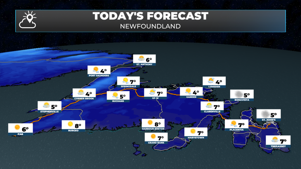
Eastern Newfoundland / the Avalon: Morning cloud gives way to afternoon sunshine. Highs 5 to 7, with a brisk northwest wind, strongest on the Bonavista Peninsula. Clear and cold tonight, lows near 0 to -2.
Central: Mostly sunny and cool, highs 4 to 6. A breezy northwest wind, especially toward Twillingate and the coast. Clear and cold tonight, with lows of -2 to -4 inland, so expect frost.
West Coast: Mostly sunny after a frosty start, highs 4 to 6. Any leftover slush on the higher elevations around Corner Brook and the Long Range Mountains will be slow to melt. Mostly clear tonight, lows near 0.
South Coast: Sunny, and the mild spot on the Island, with highs 7 to 8 from Harbour Breton to the Burin Peninsula. A northwest breeze. Clear tonight, lows near 0.
Southwest / Wreckhouse: Sunny with highs near 6. A gusty north-northwest wind around Port aux Basques this morning, easing later in the day. Mostly clear tonight.
GNP and the Straits: Partly cloudy to mostly sunny, highs 5 to 6. Breezy from the west-northwest, around 25 to 30 km/h. Partly cloudy and not as cold tonight, lows near 0 to 4.
Labrador / the Big Land: Sunny and cool. Lab West climbs from a frosty -8 to a high near 4. Goose Bay is sunny with a high near 6. The South Coast sees highs near 6 with a breezy west-northwest wind. The North Coast is 4 and windy around Nain. Clear and cold tonight, with lows from -2 on the coast to -8 in Lab West.
Looking ahead: Wednesday starts sunny and milder, with highs climbing back to 9 to 12 for most of the Province. It won’t last, though. The next system arrives in the Southwest late Wednesday, with rain and wind around Port aux Basques in the afternoon, and Lab West could see snow showers later in the day. That rain and wind spread across the Island Wednesday night into Thursday. I’ll have more on the timing and wind later today, so enjoy today’s sunshine.
📱 Get the Sheerr Weather App in the Apple App Store and Google Play Store.
🗺️ Check out the Map Room to see all the latest weather observations for the Province.
🎥 Check out the Provincial Highway Cams to see 👀 what’s going on around our highways.