
The warmth continues on the Island while damp weather takes hold in Labrador
An area of low pressure circulating off the coast of Labrador will drive unsettled weather across parts of the region over the next 24 to 36 hours. While rain and fog take hold along the coast of Labrador tonight and Thursday, the Island will see numerous showers, primarily focused on the West Coast overnight and eastern areas Thursday.

This evening’s forecast is sponsored by The Apex Team with RE/MAX Infinity – taking you to the Apex of your real estate journey. Connect with one of their experienced agents today and get top dollar for your home. Visit: www.ReachTheApex.ca for more or find them on Facebook.
That rain that falls throughout Labrador is certainly much needed, and will primarily focus along the coast between Thursday and early Friday morning. A widespread 10 to 20 mm is on the way, with locally higher amounts possible.
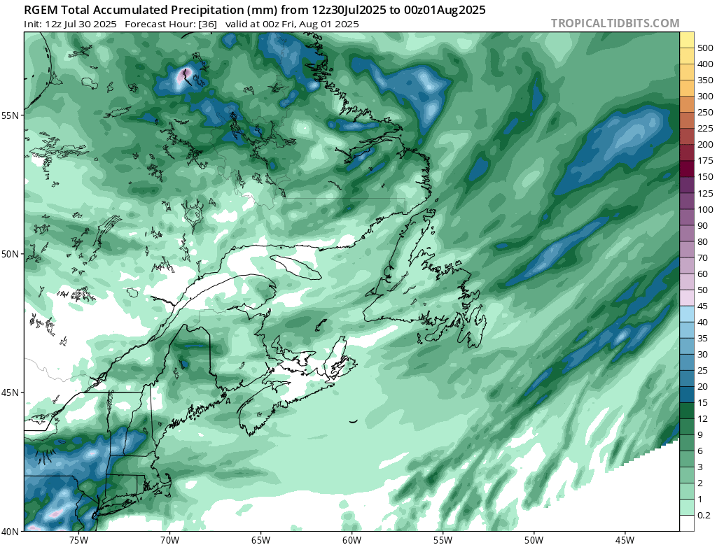
Expected rainfall between tonight and late Thursday afternoon
On the Island, not much rain is expected overnight and Thursday, or even Friday for that matter. There will be some showers, and some areas will pick up a quick 5 to 15 mm, but it will not be widespread, and it’s very hard to predict which areas will see that. I can generalize and say the best chance of that kind of rain will be the West Coast tonight and parts of eastern Newfoundland on Thursday.
The next chance of meaningful rain on the Island will be Friday night into Saturday, and that will be for the Avalon. An area of low pressure will pass offshore and may be close enough to bring significnat rain to the area in that time frame. Right now the best chance for heavy rainfall is over the southeastern Avalon Friday night. There is still some uncertainty here, and some guidance indicates very little rain will fall. Like with winter storms, this forecast will clear up in the next 24 hours.
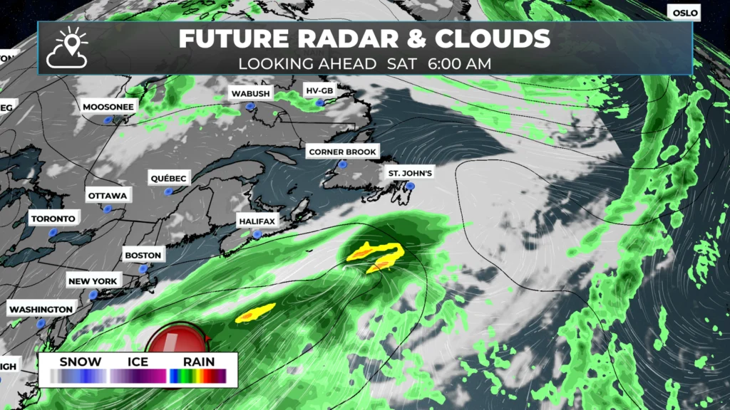
Beyond that, the weather looks fairly quiet across much of the Province as we head into the weekend. To get the detailed forecast for your area, make sure you download the Sheerr Weather App or be sure to check the forecast pages here on the website!
My next update will be up bright and early tomorrow morning!
Website is great Eddie. But we miss you. The Regatta really missed your incredible spirit you always brung
Eddie
You are doing an awesome job, happy to be able to watch your Sheerr weather reports
Thanks Eddie. Wondering if you’ll be adding humidity %?
Love Love the Sheer weather app . Love when it sends me a notice that’s there’s a new weather update .
We are having thunder and lightning here in Holyrood now but no rain!!
Love the app Eddie!!!
New to the app Eddie. Enjoying it.
Heavy thunder and lighting in St. John’s. Now heavy rain.
And the thunder rolls. No power in the Pearl.
How long do you expect these thunderstorms to last? A few hours?
CATS GONE WILD HERE IN THE DICE. POWER GONE. MICHAEL MYERS COME EARLY?!
Power has been flickering near Quidi Vidi, but still holding:). I really like the little lightnings on the radar! ⚡️ ⚡️⚡️
Staying in pippy park in a pop up. It got scary for a bit!