
Wednesday morning’s weather brief — August 20, 2025
Wildfire Update from 8:30 PM yesterday (August 19, 2025)
The Kingston Fire
Increased by 958 ha, now estimated at 10,708 ha.
Active on the western and southwestern edges; smoky conditions in the southwest corner.
No threat reported to Victoria or Salmon Cove today.
Suppression efforts included:
Light-capacity helicopters and ground crews (NL & Ontario) on the northwestern area.
Five heavy-capacity helicopters on the western edge.
Canadian Armed Forces and volunteer firefighters on the northern community areas and eastern boundary.
Forecasted precipitation may limit aerial suppression in the morning, but ground crews will continue.
The Martin Lake Fire
Estimated at 1,770 ha (no significant growth today).
Bucketing helicopters continued aerial suppression.
Ground crews (NL & BC firefighters) worked all quadrants of the fire.
Smoke expected to reduce tomorrow, but fire remains active.
Route 360 (Bay d’Espoir Highway) reopened today.
Access to Rushy Pond Road, Martin Lake Road, and Miguels Lake Road remains closed.
All other cabin access areas off the highway are open.
Paddy’s Pond Fire
Still hot and smoky, but boundaries are holding.
Most of the perimeter contained.
Crews focused on fuel break construction and ground suppression.
Worked by Provincial ground crews, BC firefighters, and Canadian Armed Forces.
No aerial support was required today.
Source: Fisheries, Forestry and Agriculture, Newfoundland and Labrador
This update is brought to you by Roebothan, McKay and Marshall.

Visit MakeTheCall.ca for more!
Good Wednesday morning!
Yesterday’s area of low pressure is swirling in the North Atlantic this morning and will have a big impact on our weather today. The rain from yesterday is done (minus a few showers), but it will be a very fall-like day for many on the back side of the large circulation.
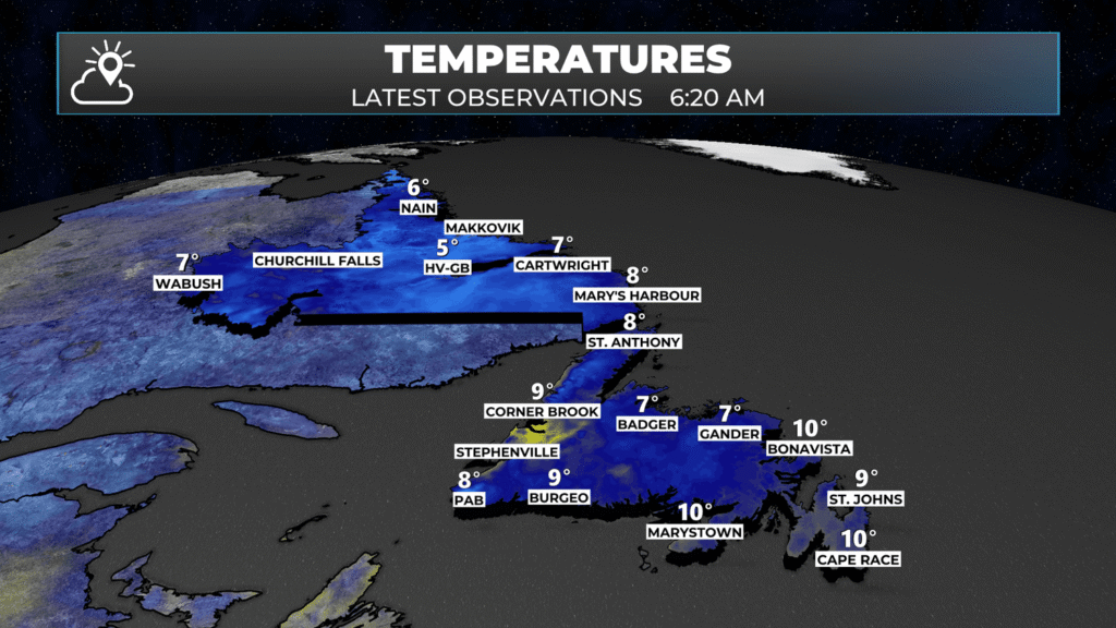
We are waking up to the coolest and breeziest morning we’ve had in quite some time over a good chunk of the Island portion of the Province. Temperatures are generally in the single digits to about 10º as of 5:30 AM NDT, so if you’re about to step out the door for a walk, a jog, or just heading to work, you may need an extra layer!
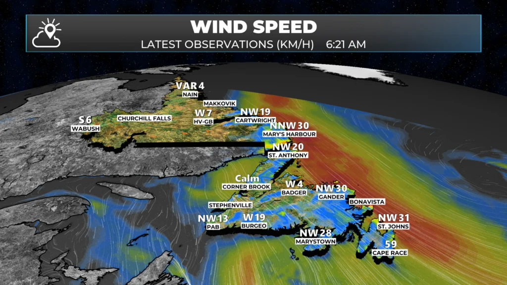
Wind speeds are highest from the southern Labrador Coast to the Avalon Peninsula, where speeds are sustained at 20 to 40 km/h from the northwest. Gusts are as high as 50 km/h in some areas. The wind speeds will generally slack off throughout the day.
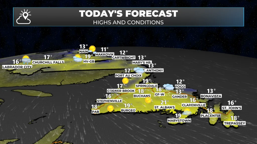
From a geographic perspective, much of the Province will see sunshine today. The exception will be the southern coast of Labrador, the Northern Peninsula, parts of central and northeastern Newfoundland, and the Avalon, where clouds will hang tough through much of the day. That being said, areas that do see clouds should see them start to decrease this afternoon.
The hourly forecast from the Sheerr Weather App for my area of the Metro shows the a decrease in cloud cover beginning around 5 PM today. Based on other data I’m seeing this morning, that seems reasonable.
Temperatures today will climb into the teens to about 20º for highs. It will be warmest for the interior areas of Labrador and southern Newfoundland. The onshore/offshore flow pattern will be very easy to spot today. It will be cooler north in the onshore wind, and warmer south in the offshore wind.
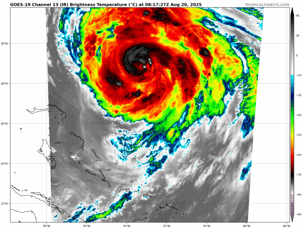
HURRICANE ERIN UPDATE
As of 3:30 AM NDT, Hurricane Erin was a Category 2 Hurricane, packing winds of 155 km/h (100 mph). The storm was moving north-northwest (345º) at 20 km/h. The central pressure was 954 mb. The centre of the storm is located 570 miles west-southwest of Bermuda and 795 miles southeast of Cape Hatteras, North Carolina.
The forecast for Erin continues to indicate the storm will pass southeast of Newfoundland between Saturday and Sunday. Direct impacts on the Island portion of the Province looks to be minimal to none based on this track.
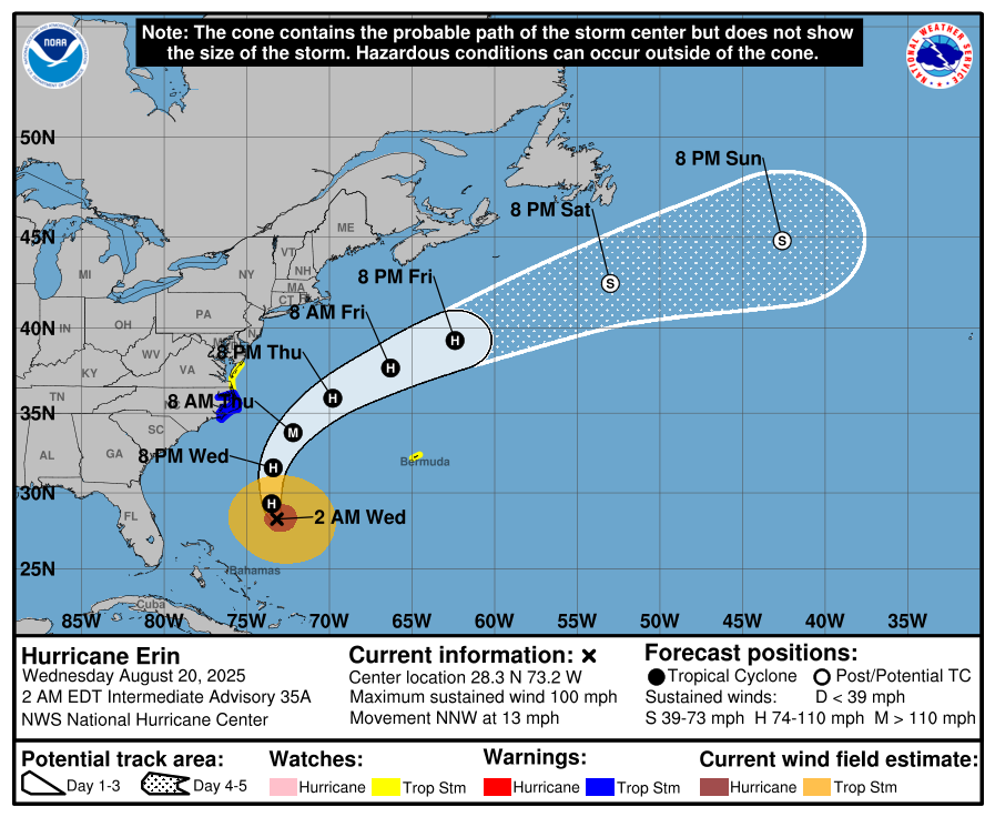
The hurricane will generate some large waves and swell as it passes near the region over the weekend. Marine Atlantic currently states there are no impacts to their service at this time, and they will continue to monitor upcoming forecasts. They state that updates will be provided as they become available through their website.
My next update will be posted this afternoon… or earlier on social… have a great day!
Thanks Eddie
Good morning Eddie thanks for your forecast
Thanks Eddy for keeping us informed 💕
I’m late to using your app but I sure do Love it 👍
Great updates as always, love the bullet format at the top.
Plans to cross the ferry to the mainland this weekend – odds the boat will sail – 50/50??
Thanks for the update Eddie
Thanks Eddie.
Thanks Eddie, Look forward to it every day
Thanks for the update as we are heading home on Friday night crossing. Keep up the great work on all elements of the storm and fires.
Thank you Eddie have a great day 👍👍
Thank you Eddie have a great day, love your app
Excellent Eddie!!! Keep up the great work.