
New Evacuation Orders Given as Unusually Warm and Dry Weather Pattern Settles In
CLICK HERE FOR THE LATEST EVACUATION ALERTS
As we move through this week and into next, the weather across Newfoundland and Labrador will remain largely quiet — but not in a good way when it comes to wildfire risk. We’re heading into a prolonged stretch of very warm and dry conditions, with little to no meaningful rain in the forecast for the next 7 to 10 days.
Short-Term Forecast
Winds across the Avalon are currently from the northeast and east, which is pushing smoke from the ongoing Kingston fire back toward inland areas like Carbonear and possibly as far as Harbour Grace. Winds will remain light through the evening, then shift back to the southwest tomorrow. That change should help push some of the smoke offshore again.
Temperatures today are running cooler than Monday — around 18°C in St. John’s and 16°C in Grates Cove — and humidity is slightly higher. That means fire behavior today may not be quite as aggressive as yesterday. But that reprieve will be short-lived.
Air Quality
An Air Quality Alert remains in effect through tonight and into Wednesday for Avalon North and St. John’s and vicinity due to wildfire smoke. If you’re in a sensitive group — young children, seniors, pregnant individuals, or anyone with respiratory issues — it’s best to stay indoors. Turn off your air exchanger if you have one, as that pulls in outdoor air. Mini-splits can remain on since they recirculate indoor air.
Mid-to-Late Week: Heating Up
Starting Wednesday, the pattern begins a sharp warm-up across the entire province. The ridge building in the upper atmosphere — what meteorologists call a heat dome — will anchor in for several days. This will bring temperatures 8 to 10°C above seasonal norms in some areas, especially heading into the weekend.
Avalon (North): Mid to upper 20s over the weekend and into next week with no more than a 10% chance of rain.
Central Newfoundland: Upper 20s to low 30s all next week. No significant precipitation in sight.
Western Newfoundland: Mid to upper 20s, with just a slim (20%) chance of rain on Sunday.
South Coast & Northern Peninsula: Low 20s, dry, and unusually fog-free for this time of year.
Labrador (Goose Bay area): Upper 20s to low 30s through at least Tuesday.
This kind of setup is rare for August and makes for excellent summer weather — unless you’re a firefighter or someone living near an active fire. The problem is that this pattern does absolutely nothing to help us in terms of wildfire danger. If anything, it worsens it.
No Relief in Sight
With virtually no rain in the forecast, already dry fuels will become even more volatile. We’re likely to see continued — if not increased — wildfire activity. That’s why it’s critical to heed the provincewide fire ban, which remains in effect until at least September 7.
Even something as small as a spark could set off another fire. And with resources already stretched, the margin for error is extremely small.
If you need a detailed forecast for your area, you can always check the Sheerr Weather app (available on the Apple App Store and Google Play)
Latest Evacuation Orders – 5:57 PM | AUGUST 5, 2025
Due to shifting winds and active fire behavior, new evacuation orders and alerts have been issued across parts of eastern Newfoundland.
🔴 Evacuation Orders (Leave Immediately):
Sections of Holyrood: From the town boundary in the northeast to 377 Conception Bay Highway (Irving Gas Bar).
➤ Travel south on Route 60 and register with the Red Cross at Robert French Memorial Stadium in Conception Bay South or call 709-729-0921.Unincorporated area of Perry’s Cove
➤ Travel south on Route 70 and register at Persalvic School Complex in Victoria or call 709-729-0921.Still in effect for:
Small Point–Adam’s Cove–Blackhead–Broad Cove
Western Bay
Unincorporated area of Kingston
Sections of Conception Bay South and Holyrood
🟡 Evacuation Alerts (Be Ready to Leave):
Town of Salmon Cove
Unincorporated area of Ochre Pit Cove
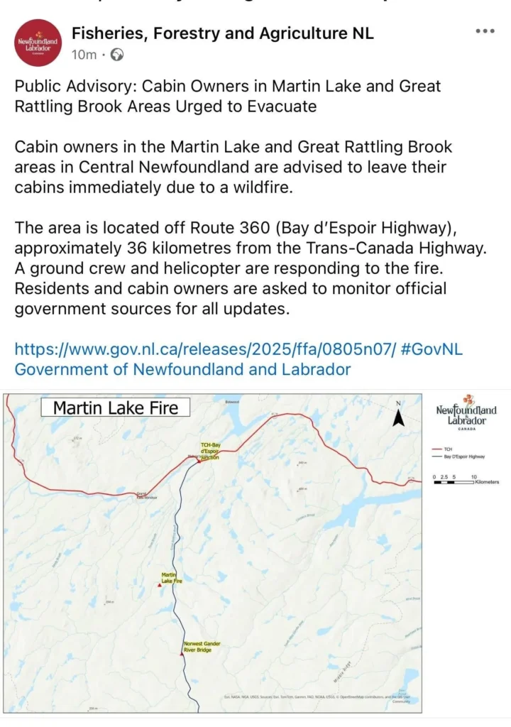
As more details become available, I will try to share them as best I can. Be sure to get the Sheerr Weather app if you haven’t gotten it yet!
Love you Eddie keep up the hard work, always look forward to your updates no matter how scary they can be lol
No I am his #1 fan!!!
Well that’s awkward
Excellent forecast and up to date on the fires
Very up to date Weather and fire information Eddie, great job!
Ty for the excellent updates.
Thank you for the update.
Great updates Eddie!
Great update Eddie thank you 😊
Great job on the updates Eddie!!!!!
Thank-you Eddie for the.updates, good job!
The reason why there’s a wildfire is because people are smoking and throwing it or it could be that people are throwing glass outside and the sun 🌞 is attracted to glass and the glass lit on fire.
Thanks for the updates
Thank you Eddie!
Thanks Eddie for the updates.