
Tuesday Morning Update — August 12, 2025
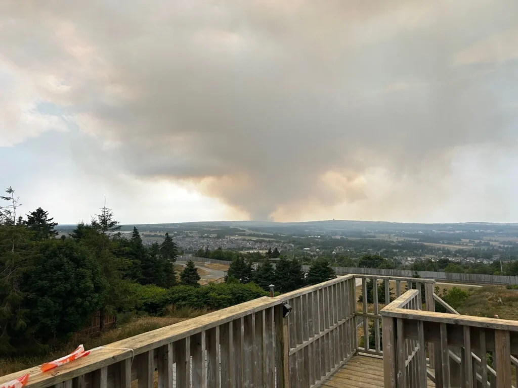
The Paddy’s Pond Fire | Credit: Paul Byrne | Location: Killbride | Date: August 11, 2025
I’m delving into the latest satellite imagery from the NASA FIRMS (Fire Info. Resource Management System US/Canada), and it does show there has been some growth on the north side of the fire overnight. This is not a surprise, as the fire cannot spread to the east due to the pond, and even though a westerly wind is pushing the fire east, growth will still occur on both flanks. This is the part of the fire Premier Hogan said was being actioned yesterday evening. In my opinion, this will be the focus again today.
While I’m not an expert in fire suppression or behavior, I expect the growth today to continue on the north and south flanks of the fire. Due to the wind direction, the growth should hopefully be manageable and slow. That being said, the weather today will be ideal for fire growth, so it’s essential to check for updates on the fire’s status and possible new evacuation orders.
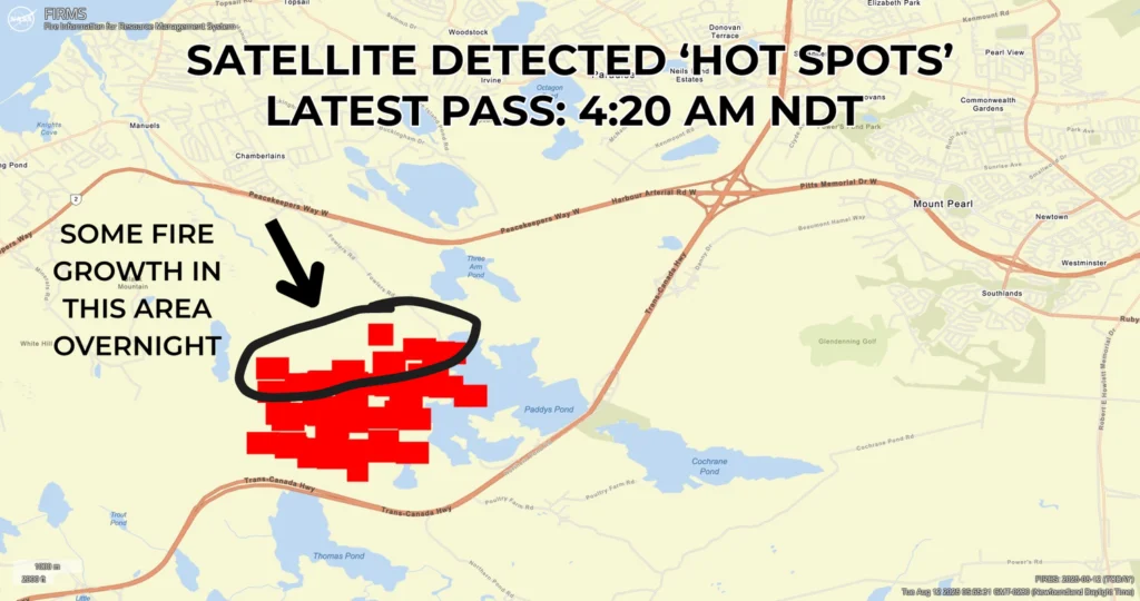
Due to the fire’s proximity to parts of Paradise and Conception Bay South, Evacuation Notices (not orders) were given out to parts of both communites. Both CBS and Paradise put out their own maps showing the areas under the notice. I received a message from Lucas O’Leary early this morning which combined the two and makes the areas under the notice easier to see.

Credit: Lucas O’Leary. Visit www.gov.nl.ca/alerts for the latest information on the fires.
The morning’s update is brought to you by Roebothan, McKay and Marshall.

Visit makethecall.ca for more!
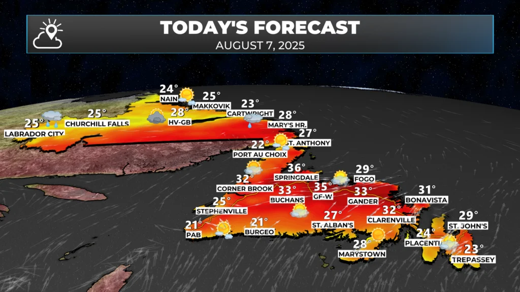
The wind forecast for today is westerly to west-southwesterly, which has been the same since yesterday. That being said, the wind is forecast to be a little slower than yesterday. Temperatures are going to be near 30º this afternoon and humidity will be low. This will be another challenging day on this fire, as well as on the other fires burning on the Island.
The combination of the hot temperatures, low humidity, and breezy conditions will create Extreme Fire Danger over parts of the Province and Atlantic Canada today. The Fire Danger Rating map forecasts how easily fires could start and spread based on today’s weather, fuel dryness, and vegetation conditions. The scale moves from low (blue) and moderate (green) danger, where fires are less likely and slower to spread, to high (yellow) and very high (orange) danger, where fires can ignite readily and spread quickly. Red areas mark extreme danger — where fires can start with very little cause, grow explosively, and become unpredictable.

Today, extreme danger is indicated for parts of eastern Newfoundland, the south coast, and scattered pockets in other parts of Canada. When paired with the high HFI values in these same areas, this combination signals that both the likelihood of ignition and the severity of potential fires are elevated, making vigilance and rapid response essential.

Another factor we can look at is Head Fire Intensity (HFI) — a measure of how much energy a fire’s leading edge could produce if it starts, expressed in kilowatts per metre (kW/m). While the Fire Danger Rating tells us how easily a fire could ignite and spread, HFI shows us how intense and difficult to control that fire might become once it’s burning. Lower values (0–10 kW/m, shown in deep blue) mean minimal spread and easier suppression. As values climb into the greens and yellows (10–2,000 kW/m), flames grow faster, and firefighting becomes more challenging. Bright yellow, orange, and red areas indicate intensities over 4,000 kW/m, where crown fires are possible, and suppression without heavy aircraft support becomes extremely difficult.
For fires already burning — like those in parts of Newfoundland — elevated HFI values today mean suppression crews could be dealing with aggressive, fast-moving fire fronts if weather and fuel conditions align. In areas where high or extreme fire danger overlaps with high HFI, any new flare-ups or edge growth could happen quickly and with enough intensity to challenge even well-supported firefighting efforts. This combination increases the risk to nearby communities and underscores the importance of evacuation readiness where alerts are in place.
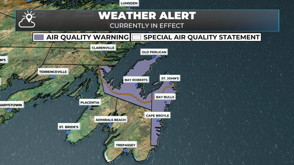
The smoke from these fires is impacting air quality in the regions directly downstream (east) of where these fires are burning. Air Quality Statements and Warnings are currently in effect and are likely to remain so for some time. For more details on what to do if you’re experiencing poor air quality, click here.
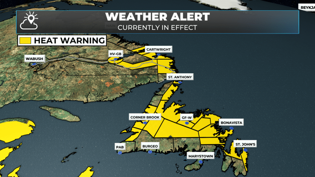
A Heat Warning remains in effect for much of the Island until at least Thursday. Highs will be near 30º with lows near 16º through the time frame. Humidex values will also be in the mid to upper 30s for some areas. Make sure to take preoperative precautions, such as staying hydrated, if you will be working outdoors for an extended period.
Is there rain in the forecast?
As of this writing, it does look like we will see a chance of rain across parts of the Island on Thursday (west and central) and Friday (east). The rainfall amounts do not look to be prolific, but anything would help right now. Additionally, there should be a marked increase in humidity levels after today, which should help slow the rate at which the fires can spread to some extent.
I’ll have a full forecast posted later today and will provide updates on the fire situation as soon as possible. If there are any livestreams from the Province, you can watch them on the LIVE page. Follow me on socials for more frequent updates, and be sure to get the app.
This kind of personalized, detailed and relevant weather coverage is what makes this app great. Thanks Eddie!
Appreciate the detail in this update Eddie. Thanks!
What is the air support layout for today
Thank you so very much for the update
Clear and concise information, with some terms explained. This is a very good app. I learned of it at Matt Wright’s show and told many others. Thank you for all your efforts.
Thank you, your app does a great job on our local weather and news. When I want to get updates, I go to your app.
Thanks for the update, as always you educate and give all the needed info to go about our days. Prayers being sent for those who are displaced or on the alert to do so
Fantastic work Eddy! Very detailed & relevant.
Thanks Eddie,
This detail and analysis of the wildfire situation in the province and especially on the Avalon is much appreciated. The mixture of wildfire and weather helps understand what to expect today.
We appreciate all your updates, Eddie. Praying for all the people affected and all those fighting the fires.
Thank you Eddie for this update. Greatly appreciated.
Fantastic job, Eddie! Thank you!
Thanks Eddie
Thank you for your update!
Thank you so much Eddie for your update much appreciated.Have a great day.
Thank you Eddie for your in-depth coverage. Appreciate it very much.
Thanks, Eddie.
We appreciate this so much! Thank you
Thanks Eddie really appreciate your updates.
Thank you for your very detailed updates I truly appreciate it.
Thank you Eddie, This is very easy to understand,,you go beyond sir!
Thank you so much for keeping the people informed with accurate and uptodate information. The hard work is appreciated beyond words!
Disappointing that there is NO information given on the over 5000ha fire ripping through the North Shore, CBN.
As soon as something happens inside the overpass everyone else is an afterthought.
I had no information on it and I don’t want to be sharing information that is not accurate in a sensitive time. An update was just put out by the province and I have that posted as well.
Just a small point. The Paddies pond fire is outside the overpass so technically its not in town. Can’t even smell smoke from my deck in St. Philip’s.
There is a fair bit of smoke being directed south of the metro right now. It’s seen on satellite images