
Showers for parts of NL close out the work week — August 22, 2025
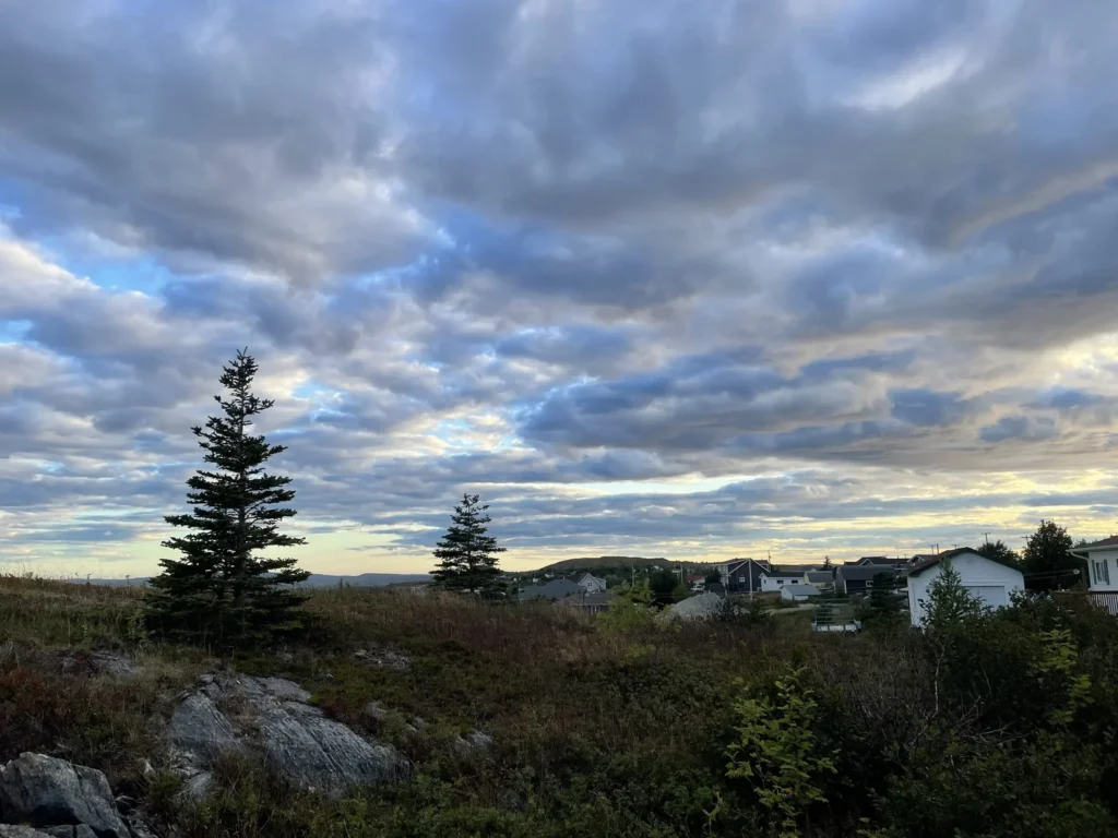
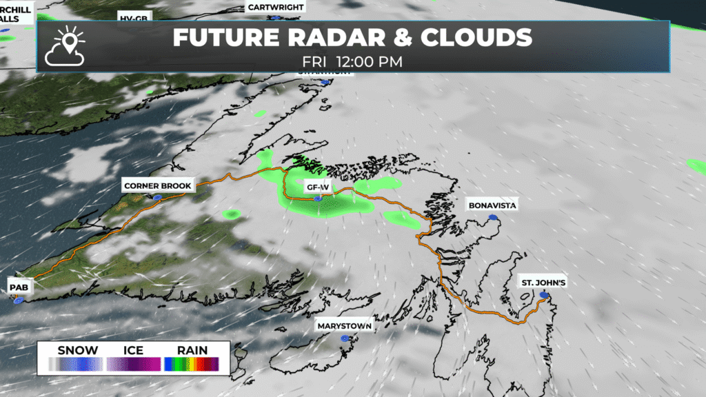
Clouds over Upper Island Cove. Credit: Jason Power
Wildfire Status Update (as of 9 PM on August 21, 2025)
• Paddy’s Pond Fire: Under Control
After several days of dedicated work by NL, BC, and Canadian Armed Forces ground crews, the Paddy’s Pond wildfire is now classified as “Under Control”. This means the wildfire has received sufficient suppression action to ensure there will be no further spread of the fire.
The British Columbia crew will move from Paddy’s Pond to the Kingston wildfire to provide support tomorrow, and local NL ground crews will continue to be on site to action any hot spots that may persist.
• Martin Lake Fire: Held
The Martin Lake wildfire remains as “Being Held”. Ground crews spent the day digging into hot spots, and ground suppression work will continue tomorrow.
• Kingston Fire: Out of Control
Crews reported another strong day of fire suppression on the Kingston wildfire from both the air and ground. Aerial mapping was completed, and the perimeter of the wildfire is now estimated at 10,095 hectares.
Today’s clear skies allowed for steady aerial attacks. In the western area, eight water bombers worked the boundary lines and finished the day with a mission at the southern edge. Five heavy-capacity helicopters actioned the north edge.
Crews from the province and Ontario spent the day at either end of the wildfire, providing ground suppression along northern and southern edges. Structure protection was actioned by local fire departments and the Canadian Armed Forces were in priority areas working hot spots.
This update is brought to you by Roebothan, McKay and Marshall.

Good Friday morning!
Friday is going to be a relatively quiet day across the Province as we are between weather-makers. Temperatures will be comfortable to cool. Highs range from the teens to the lower 20s. It’ll be coolest along the Labrador Coast and near/along north and northeast facing shores of the Island.
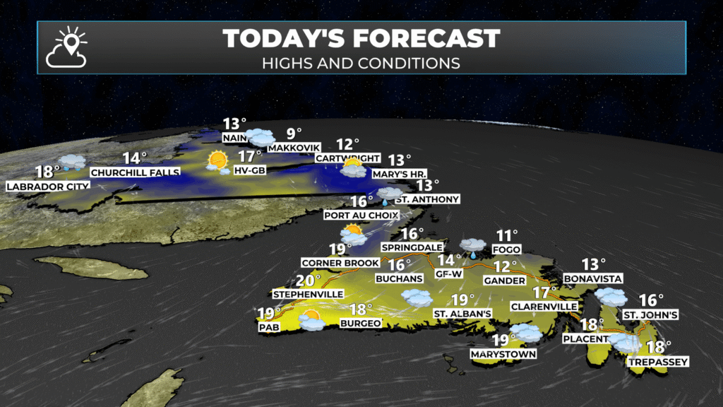
The area of low pressure that brought us the rain a couple of days ago has one more gift for us before it departs. An area of showers will graze the Northern Peninsula, parts of central and the northeast coast of the Island today, particularly this morning.
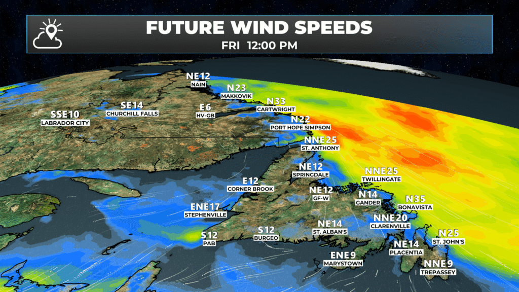
Additionally, breezy conditions are expected along the coast of Labrador, the northeast tip of the Northern Peninsula, and the area along the northeast coast from near Twillingate to the Bonavista Peninsula. Those speeds will gradually slow down throughout the day.
HURRICANE ERIN UPDATE – DATA FROM THE CANADIAN HURRICANE CENTRE
As of 3:30 NDT, the centre of the storm was located 681 kilometres south of Yarmouth, Nova Scotia. Maximum sustained winds were 157 km/h, and the movement of the storm was toward the east-northeast at 34 km/h. The minimum central pressure was 952 mb.
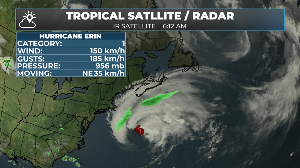
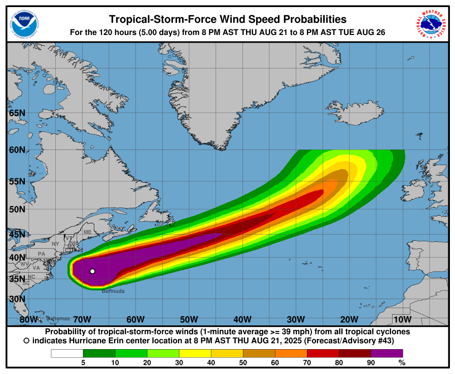
Forecasts for Erin continue to indicate that the storm will stay well offshore of Nova Scotia and Newfoundland as it passes between today and late Saturday or early Sunday. While widespread wind impacts aren’t expected, gusts to 70+ km/h are possible along exposed areas of the southwest coast of Nova Scotia today and the southeastern area of the Avalon Peninsula tomorrow (Cape Race area).
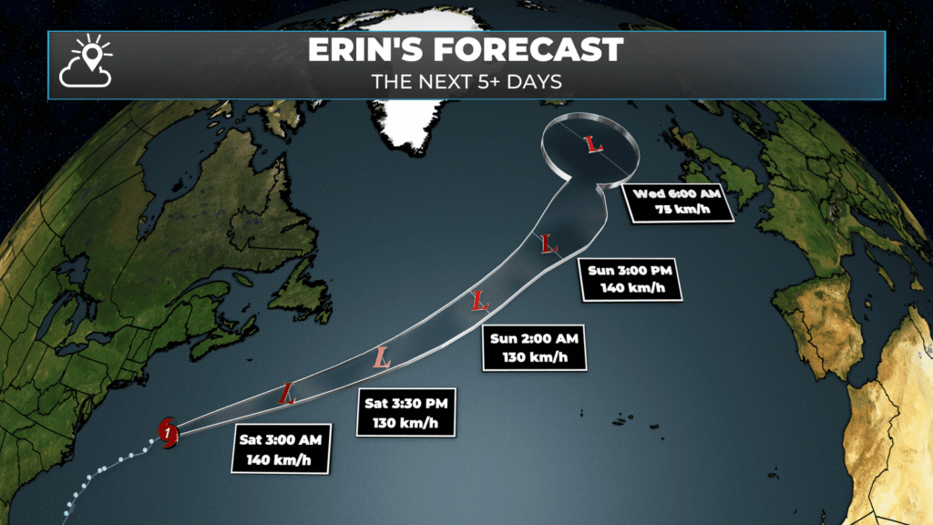
Gale to storm force wind warnings are in effect for the waters southeast of Newfoundland, while Hurricane Force Wind Warnings are in effect for the south Southern Slope waters and the Southwestern Grand Banks. Maximum wave heights offshore will be as high as 8 to 11 metres, with breaking wave heights of 3 to 5 metres expected along the coasts of Nova Scotia and the southern Avalon Peninsula.
While widespread heavy rainfall isn’t expected, there is a chance that some rain will move onshore onto the Avalon Peninsula overnight into Saturday morning. I’ll be watching the radar closely to see if this comes to fruition. Any rain we can get would be a huge help!
Good morning Eddie & thank you for the update!
Bring on the rain & get fid of these destructive wildfires !
Have a great day!
Good morning Eddie .. Thanks for the update , it’s the first thing I look forward to seeing in the morning. Hopefully the rain will once again help the fires . Enjoy your day and stay safe.
Thank You for the Update.
Good morning and thank you
GOOD MORNING EDDIE AND THANKS FOR ALL THE UPDATED AND YOUR DOING A GREAT JOB.
Thank you Eddie. Have a great day
Thank you very much for keeping us informed Eddie. Your updates are something we look forward to everyday. Keep up the good work bud.
Good morning! Thanks for the info. I love your weather app and use it everyday! If possible could you bring back a little bit of the Heat. Not all of it, just some of it.
Thanks! 🤣
Thank you Eddie. Love your App.
Good morning
Thanks for the updates
Have a great day
Thank you Eddie
Thank you Mr. Sheerr. Your forecast is the most accurate and easiest to understand. Cheers!
Thank you Eddie. I love your updates. Hope you have a fantastic day. Stay safe.♥️. Have a great weekend with your beautiful family.
Thank you for this thorough analysis of our weather forecast, Eddie.
Thank you for keeping me updated.
Thank you so much for the updates .have a great weekend with your family
Thank you again!
Love your app Eddie!
Thy for the update Eddie. Look forward to reading every day!
Happy weekend to you and your family.
Great update Eddie !
Keep it coming.
Great job Eddie! You’re my #1 weather source!!
Thanks for the update Eddie iI hope we get lots of rain from Erins arrival for the wildfires I hope you have a great weekend & StaySafe