
Friday morning weather brief — August 29, 2025
Good Friday morning!
Thursday evening featured some intense showers and thunderstorms across parts of central and eatern Newfoundland. The storms made for some very dramatic looking skies. This is a photo of a shelf cloud, taken in Green’s Harbour, yesterday evening.
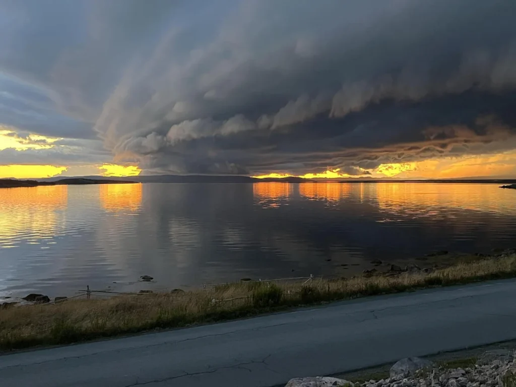
A dramatic image of a shelf cloud! Taken by Sandra Chislett in Green’s Harbour on August 28, 2025.
A shelf cloud is a low, horizontal cloud formation that appears along the leading edge of a thunderstorm. It forms when rain-cooled air rushes out of the storm, spreads along the ground, and lifts warm, moist air ahead of it, causing condensation. Shelf clouds often look like a dark, menacing wedge or “shelf” in the sky and can signal strong winds, heavy rain, or hail as the storm moves in.
This update is sponsored by Roebothan, McKay and Marshall.

Visit MakeTheCall.ca to find out what the law firm can do for you!
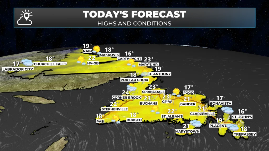
TODAY’S FORECAST
The storms we had last evening formed along a cold front. That cold front moved offshore and took the showers with it. Behind the front, temperatures dropped sharply into the lower teens, which is where most of the Island is as we start Friday. Labrador is seeing similar temperatures this morning, with perhaps some areas being a little cooler.
Temperatures today rebound into the teens and lower 20s across the Province. Weather-wise, we are looking quite today with light to moderate wind speeds and a mix of sun and cloud. Unlike Thursday, we should not see thunderstorms developing this afternoon.
SATURDAY’S RAIN
A potent area of low pressure will move over eastern Newfoundland on Saturday. This promises to bring moderate to heavy rainfall to a good chunk of the Island. The rain is expected to arrive tomorrow morning and taper off in the late afternoon or evening, moving from south to north.
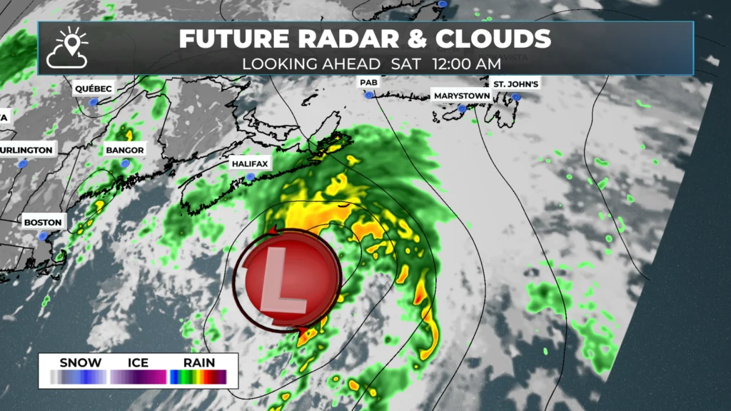
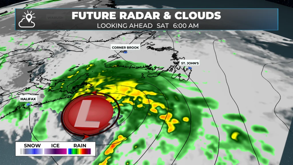
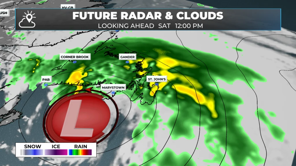
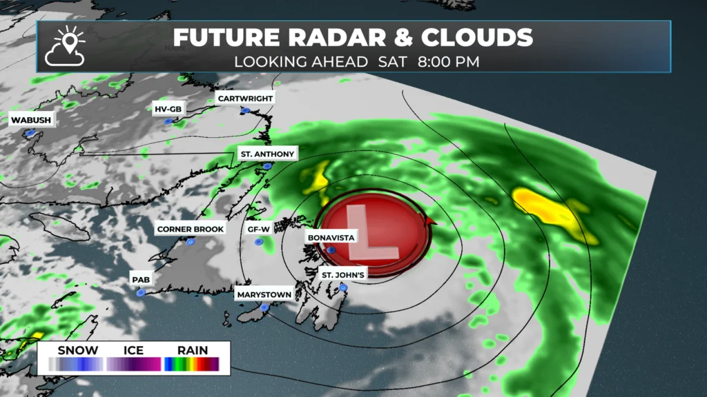
The heaviest rain will be found over eastern Newfoundland, with lighter amounts found in the west. The middle thrid of the Island will see moderate amounts. As of this morning, I’m expecting a widespread 15 to 30 mm for eastern areas, with locally higher amounts.
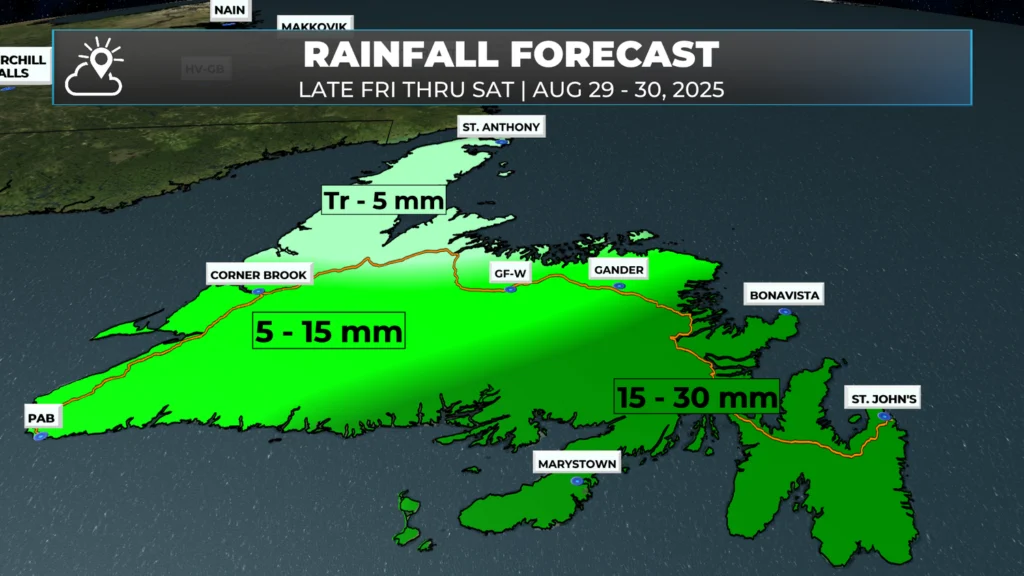
Once this area of low pressure departs, it will take the rain with it. The weather on Sunday and Monday looks nicer, although Sunday may see some more afternoon showers and thunderstorms on the Island. Temperatures look to remain mostly seasonable (teens and 20s).
I’ll have a more detailed look at your weekend forecast and a bit more about next week in my next forecast, which will be posted this afternoon.
Have a great Friday!
That piece on the shelf cloud was super interesting
Thanks, Eddie! Will welcome the rain for sure. Have a great holiday weekend
Have a great day, thanks for the update
Interesting facts about a shelf cloud!! Have a great long weekend!!
We always need rain.. And I welcome the rain to come!!!
Thanks very much Eddie. I look forward to your forecast every morning. Keep up the good work.
Sure is nice to see the rain. Have a good day
Thank you for all your hard work!