
Wednesday morning weather brief — September 10, 2025
Good Wednesday morning!
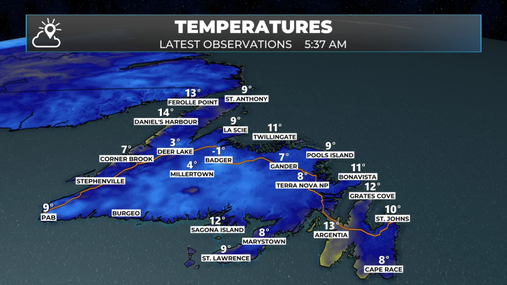
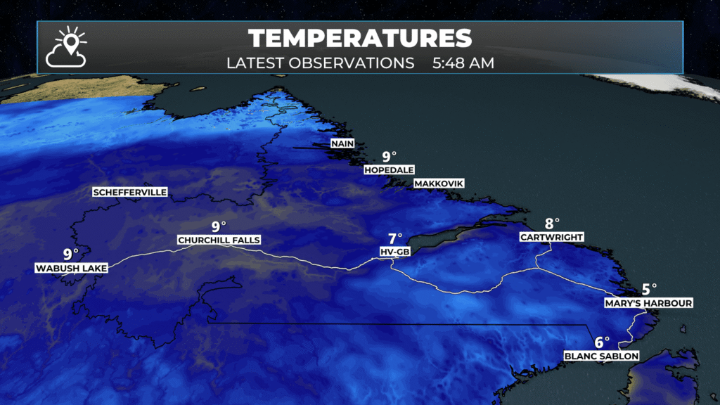
We are certainly waking up to some cool temperatures in some areas this morning, particularly between Badger and Deer Lake. Temperatures in both of those locations dropped to near freezing this morning. Deer Lake was as low as 1.0º just after 5 AM, and as of 5:30 AM, Badger was reporting -0.6º (rounded to the nearest whole number on the map). Other areas of NL weren’t as chilly, but I can bet there are a few sheltered areas of the interior and the Great Northern Peninsula that are close to freezing as I type this up!
This update is sponsored by Roebtohan, McKay, and Marshall Injury and Accident Law.

Visit MakeTheCall.ca today to learn more about what the law firm can do for you!
Today’s Forecast
Newfoundland
The weather on the Island today looks about as good as we can ask for as we near the middle part of September. Expect sunny or mostly sunny skies today. Temperatures will climb into the upper teens and lower 20s.
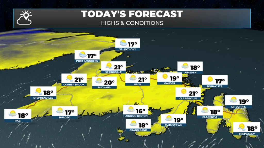
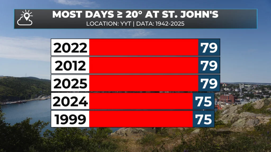
The forecast for St. John’s today is somewhere between 18º and 19º. If we can eek out a 20.0º, that would make it the 80th day of a high of at least 20º this year and would break the all-time record. I’ll be watching the obs (observations) this afternoon!
Labrador
The weather in the Big Land today will be sunny from Churchill Falls to Goose Bay and onward to most of the coast. As the day progresses, showers will move into the west and the north coast. The wind direction for parts of the north coast will turn onshore around noon, which may impact air operations to places like Voisey’s Bay and Nain.
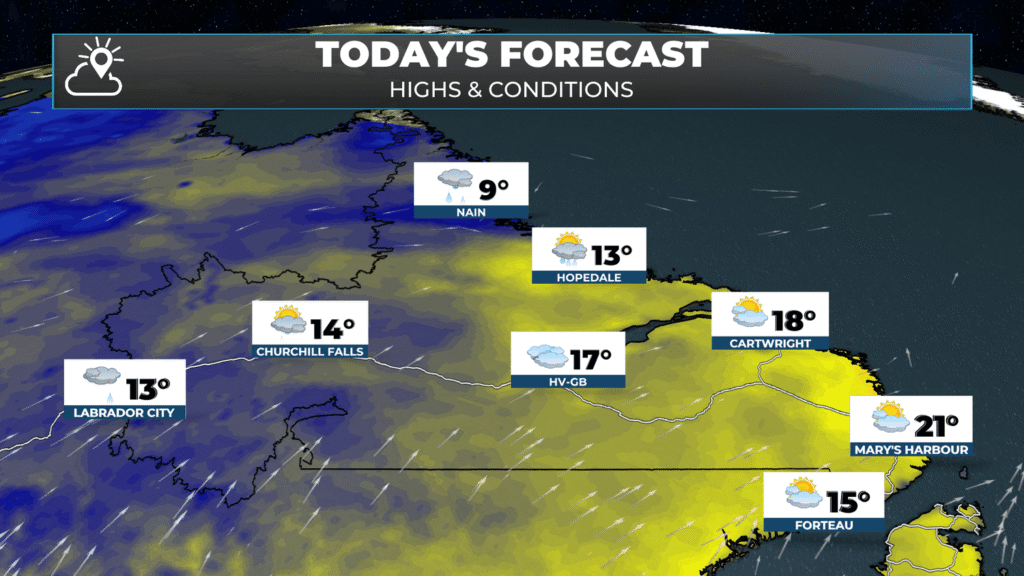
Temperatures will climb into the teens and even some lower 20s today. The warmest readings will be found in the southeast. The coolest readings will be in the North, where Nain’s high is forecast to be just 9º today.
Sneak Peak at the rest of the week
Thursday will bring more widespread rain to southeastern Labrador, particularly around Goose Bay, as well as to parts of southern and eastern Newfoundland. This is the result of two separate systems—one over Labrador and another southeast of the Island. While they won’t fully “phase” (or merge, as we say in meteorology), they will interact somewhat.
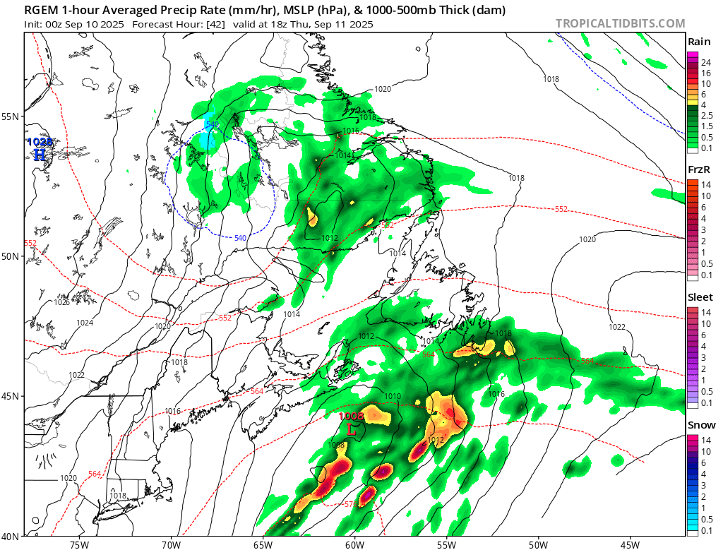
Forecast map showing where the rain and pressure systems will be Thursday afternoon at 3:30 PM NDT
The system dropping down from Labrador will be the stronger of the two, steering much of the weather in the Big Land on Thursday and across Newfoundland on Friday. The weaker system will first spread rain and showers across southern and eastern Newfoundland Thursday, followed by more frequent showers on Friday as the Labrador system takes over. For Labrador, Thursday looks wet in the southeast, but conditions should improve on Friday.
Looking ahead, the entire system appears to clear out in time for the weekend, setting the stage for a tranquil Saturday and Sunday across Newfoundland and Labrador, with seasonable temperatures.
I’ll have a more comprehensive look at the medium- to long-range forecast in my next update this afternoon.
Good morning Eddie,thanks for weather update.
Good morning Eddie. Thank you for all you do, it’s very much appreciated.
Have a great day!
Loving the app Eddie
Thanks for the update, have a great day Eddie
Thanks Eddie have a great day
Excellent
Thanks Eddie, have a nice day.
—What’s up with the CAM or Lack of coverage on the Heart’s Content barrens? Who can we CALL??