
Friday Morning Weather Brief — September 12, 2025
Good Friday morning!
Today’s weather highlights:
Expect scattered showers on the Avalon through most of the day.
Rain will fall in southeast Labrador, the Great Northern Peninsula, Green Bay – White Bay, and through much of central and the northeast coast as far south as the Bonavista Peninsula.
The rain will be most widespread in Central and on the northeast coast this afternoon; elsewhere, it will arrive this morning, if it hasn’t already.
It will get breezy for most north-facing shores of the Island today and tonight, with gusts of 50-60 km/h. There is a chance of some locally higher gusts.
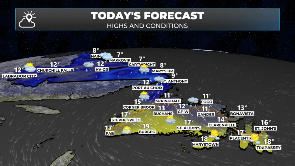
Highs of 10º to 15º Province-wide today, expect near 20º along south-facing shores.
This morning’s update is sponsored by Roebothan, McKay, and Marshall.

Visit MakeTheCall.ca to learn more about what this accident and injuary law firm can do for you.
This morning (as of 5:30 AM), we are waking up to areas of showers and rain across parts of Labrador and much of Newfoundland. The radar here, and in the Sheerr Weather app and Map Room, shows this very well. The rain showers will get less numerous for eastern and western areas this morning. While the rain coverage will increase central and northwestward onto the Northern Peninsula later this morning.
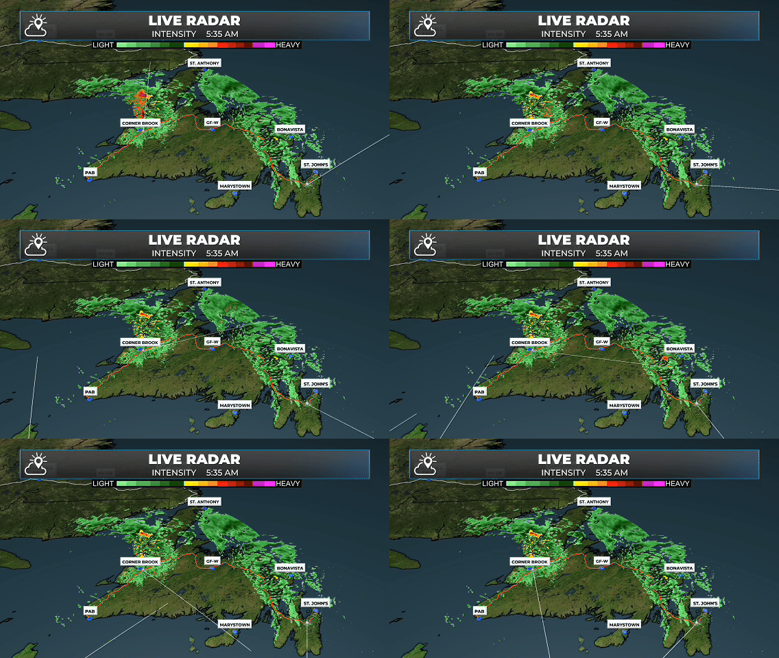
Future satellite and radar imagery shows how the showers and areas of rain will evolve as the morning progresses. This is all from an upper-level low merging with another piece of energy to its east, offshore, and a surface low. In Meteorological terms, for you weather geeks reading this, a shortwave trough is digging and is going from positively to negatively tilted, causing the precipitation field to expand on the west side of the surface low as it departs.
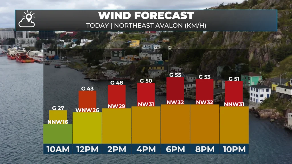
The last element I’m looking at today is the wind speed. While the forecast may not be that impressive, areas from Notre Dame Bay to Conception Bay and eastward to the Avalon’s east coast will see the wind speeds pick up this morning. Speeds will become sustained around 30 to 50 km/h, with gusts to 60+ km/h possible. There is also the chance some areas see higher speeds than this as a ‘sting jet’ develops on the backside of the departing low. Guidance indicates this should occur far enough offshore that impacts on land and near-shore should be nothing unusual. But it’s just something I’ve got my eye on.
The animation (below) shows how today’s wind field will evolve between this morning and tonight. Note the core of high winds developing just offshore? That’s the aforementioned sting jet that I noted above.
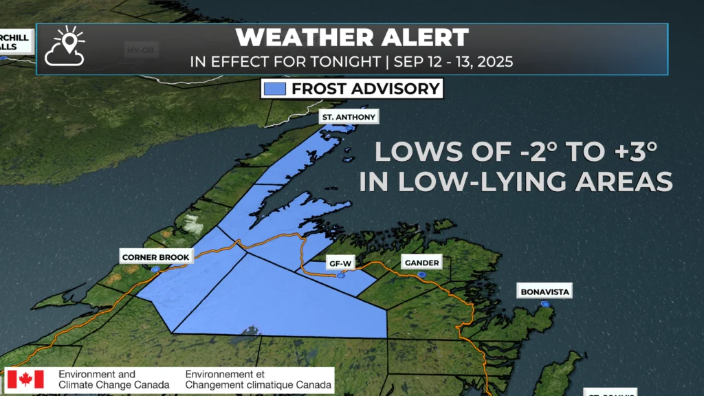
Behind this system, it will turn cooler overnight, and some frost is possible for some areas of Central and northwestern Newfoundland. The ECCC NL Weather Office in Gander has issued a Frost Advisory for the following areas:
Grand Falls-Windsor and vicinity
Buchans the Interior
Deer Lake – Humber Valley
Green Bay – White Bay
The Northern Peninsula East
Minimum temperatures will be as low as -2ºC in low-lying areas tonight into Saturday morning. We are near the end of the growing season, but if you have some plants that are sensitive to the cold weather, take precautions to keep the frost away. Here are some good tips for that.
I’ll have my next update and a detailed look at the weekend forecast posted later today.
Also, here are some things of note today!
Mary Browns is donating 50% of all Batter’s Box Sales to the Canadian Red Cross 2025 Newfoundland and Labrador Wildfire Appeal today. The Province and Federal Government are matching every $1 raised, which means 1$ becomes 3$. I’ll be at Mary Brown’s on Elizabeth Avenue around 1 PM today with some weather and chicken coverage!
I’m participating in the Haul for Hope today at St. John’s International Airport. This is an event to benefit Hope Air. Hope Air is Canada’s national charity dedicated to providing free flights and accommodations for low-income Canadians who must travel long distances to access medical specialty care. Hope Air eliminates barriers of distance and cost so that patients in financial need can travel to access the best available treatment for many life-threatening health conditions. This charity truly benefits those in NL who need access to the care they require, when they need it. If you’d like to donate to this wonderful charity, here is the link to do so.
Eddie you’re quite the busy man. Thanks for the forecast
Thanks for the very detailed weather forecast!!
Good morning Eddie, thanks for weather update and Mary brown,s chicken for wildfire fund.
TGIF….. thanks Eddie. Have a great day, and a fabulous weekend.
You an awesome wedda’ man!! “Newfinese if you Please”. 😁
The note section is a real plus Eddie- Tks for sharing.
Thank you Eddie for the update. I enjoy reading your detailed weather report.
Thanks Eddie for the update!
Thanks! Love having weather at my fingertips!
Good morning Eddie. Thank for the update it’s an awesome app. Enjoy your weekend 🌞
Thanks for the very detailed forecast Eddie, have a great weekend.
Thanks Eddie your app is our go to for weather updates every morning. You are doing a great job with every aspect of the weather forecasts’
Good afternoon Eddie!….Thank you for your detailed update!
Sheerr Weather Rocks!…Love your app!
Enjoy the rest of your Friday!