
Monday Morning Weather Brief — September 15, 2025
Good Monday morning!
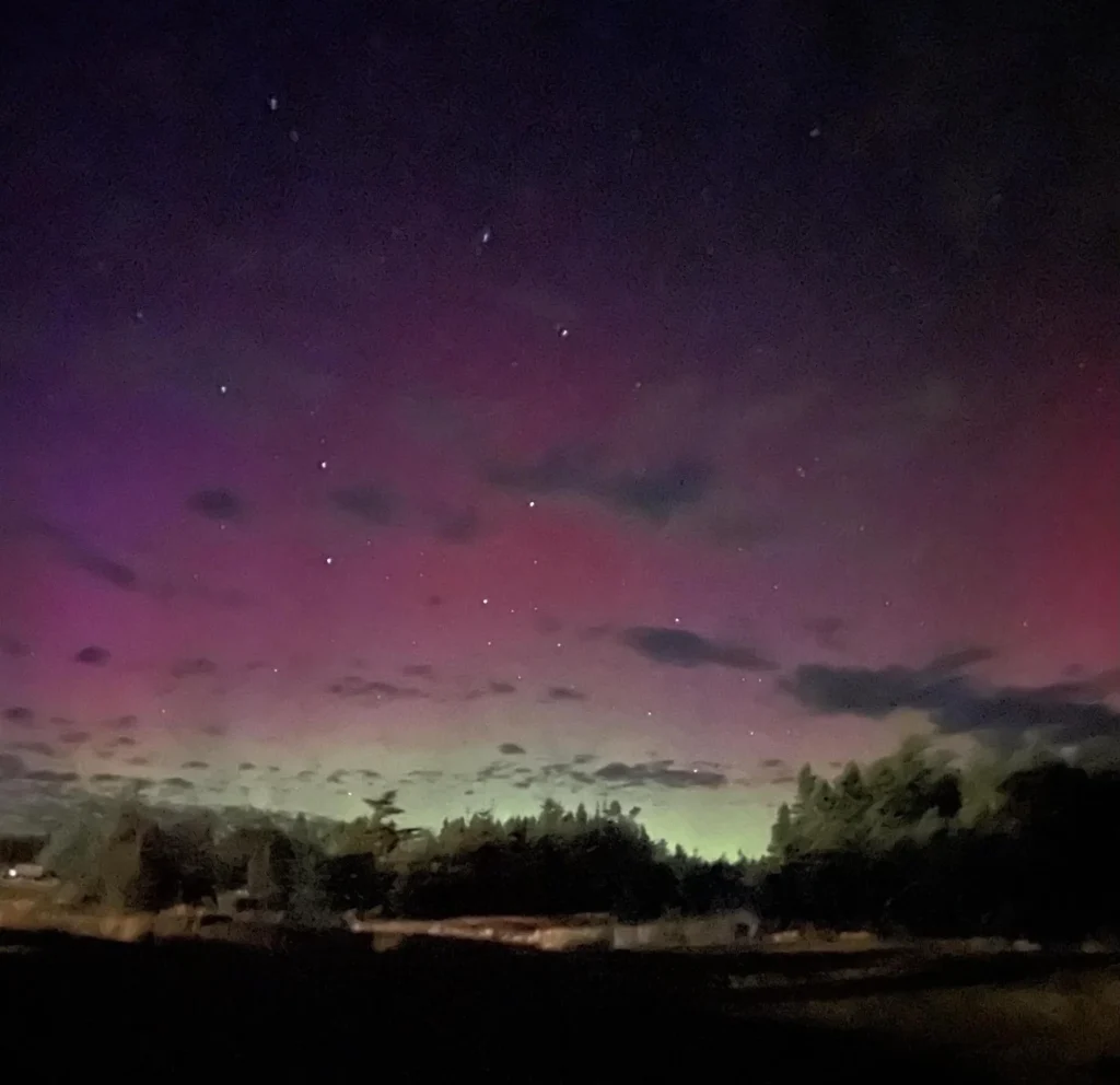
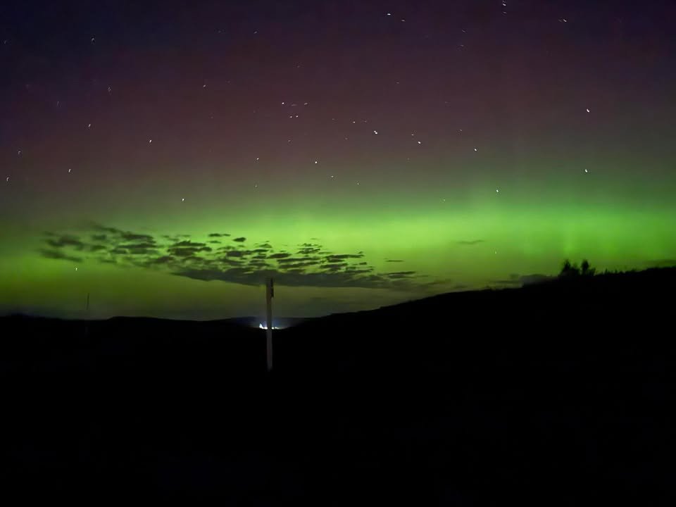
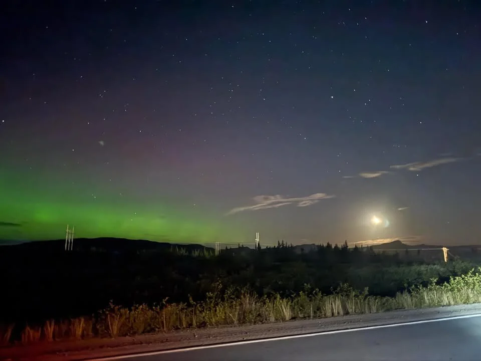
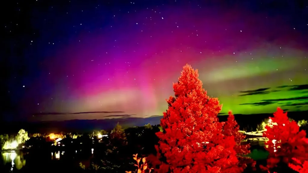
The Northern Lights made an appearance last night over much of the Province. Kp index values peaked between 6 and 7 last night, which is generally enough to allow the Northern Lights to be seen over much of the Island if the skies are clear, which they were. The Kp index is a scale from 0 to 9 that measures global geomagnetic activity, caused by interactions between the solar wind and Earth’s magnetic field. Lower values (0–2) mean quiet conditions, while higher values (5 and above) indicate geomagnetic storms, which can produce brighter and more widespread auroras.
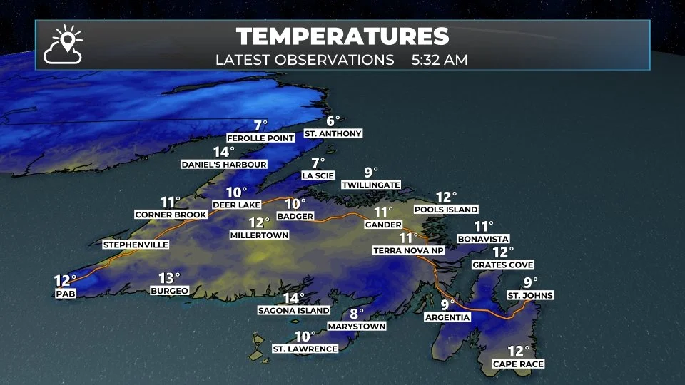
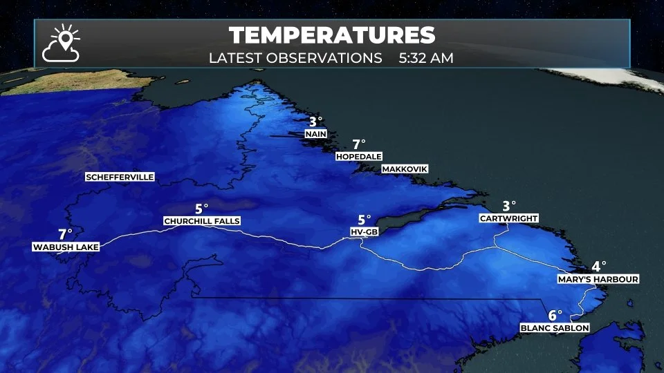
We are starting off the new work week with temperatures into the lower teens over much of the Island and middle to upper single digits in Labrador. We are likely seeing a few showers in northern Labrador and over parts of the Northern Peninsula, and in Central Newfoundland near the coast. Outside of the showers, we are looking at predominantly cloudy skies across much of the Province with a few areas of clear skies over the South Coast and parts of the Avalon.
This morning’s update is sponsored by Roebothan, McKay, and Marshall.

Visit MakeTheCall.ca to learn more about what the law firm can do for you.
Temperatures will reach the middle to upper teens this afternoon for the Avalon Peninsula, Burin Peninsula, South Coast, and much of the West Coast. Areas of central, including the coast, and the Northern Peninsula will see temperatures closer to 10º. Labrador will also see highs in the lower teens this afternoon.
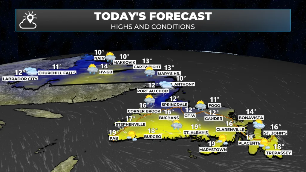
Showers will be found over the Island this afternoon along a cold front. That front will dip south during the afternoon, and some locations, like the Avalon, will see temperatures dropping this afternoon and evening to near 10º, from the middle teens. There will also be scattered showers rolling through parts of Labrador from near Goose Bay to the coast. The showers will be moving from northwest to southeast Province-wide.
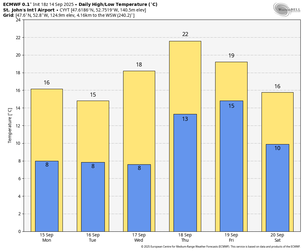
Other than the showers today, there isn’t much happening in the weather across the Province. Tomorrow (Tuesday) will be similar. It does look like the weather pattern may get a bit more active toward the middle of the week (Labrador) and late week on the Island. Speaking of later in the week, computer guidance from late Sunday night suggests that St. John’s may see its 80th day with a high of at least 20º in 2025 on Thursday.
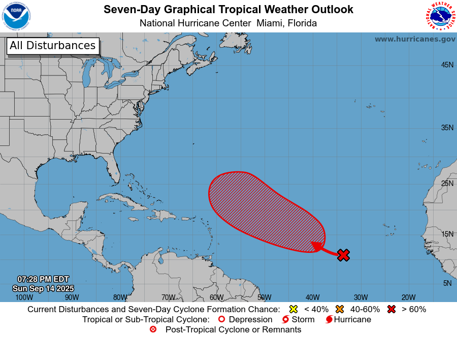
The other thing of note is the tropics. While there are no systems with names yet, the National Hurricane Center suggests one area of low pressure has a 70% chance of becoming a tropical system within the next 7 days. While this isn’t set in stone, it is a marked change from last week, when there was virtually no activity in the tropics.
I’ll have my next forecast update this afternoon.
Have a great Monday!
Good morning Eddie, Thanks for the update this morning.
As always, looking forward to reading about what’s happening in our weather. Thanks, Eddie.
Good Monday morning Eddie!..Thank you for the weather update!
Have a great day!…Stay safe!
Thanks Eddie! Beautiful photos of the Northern Lights last night!
Good Monday morning, thanks for your update..love the pictures of Northern lights !
Thanks,Eddie! Have a safe & wonderful day!
Thanks Eddie enjoy your day
Good morning Eddie, thanks for weather update.
Thanks for the update, have an awesome day
Thank you Eddie for the update, enjoy our wonderful weather.
Thanks Eddie, great update as usual. Keep up the good work.