
Wednesday Morning Weather Brief — September 24, 2025
Good Wednesday morning!
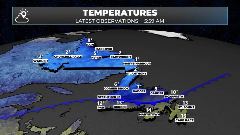
We are waking up to a HUGE variety in temperatures this morning! As of 5:30 AM NDT, it’s currently 1º in St. Anthony, -2º in Labrador City and Wabush, and 13º in St. John’s! A cold front is currently draped across the region, bringing a significant variance in temperatures. South of the front, it is warm, and west and north of the front, it’s cooler.
This morning’s update is sponsored by Roebothan, McKay, and Marshall.

Visit MakeTheCall.ca to learn more about what the law firm can do for you.
Along with those temperatures, we are seeing some scattered showers this morning. The most notable of which is near the Bonavista Peninsula. Outside of that, most of the activity seems to be rather scattered or offshore this morning. Speaking of offshore, there is a good bit of rain just missing the southeast corner of the Avalon Peninsula.
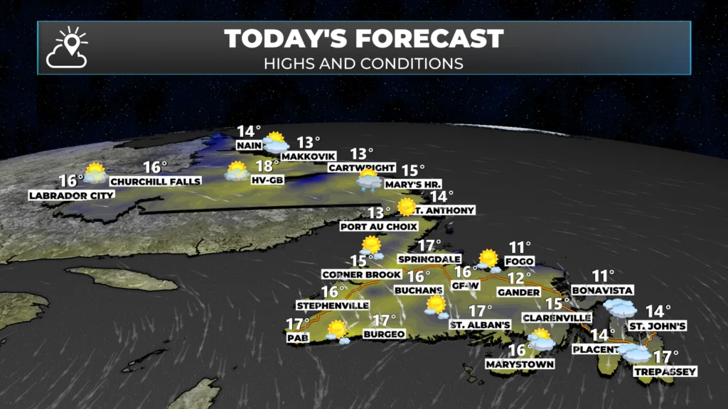
Outside of the showers, we are looking at a generally sunny day across much of the Province. The exception will be in the southeast, where clouds this morning will give way to sunshine by the afternoon. In the Metro area, it appears that the skies will clear rapidly after 2 or 3 PM. Temperatures will peak in the single digits to teens across the board today.
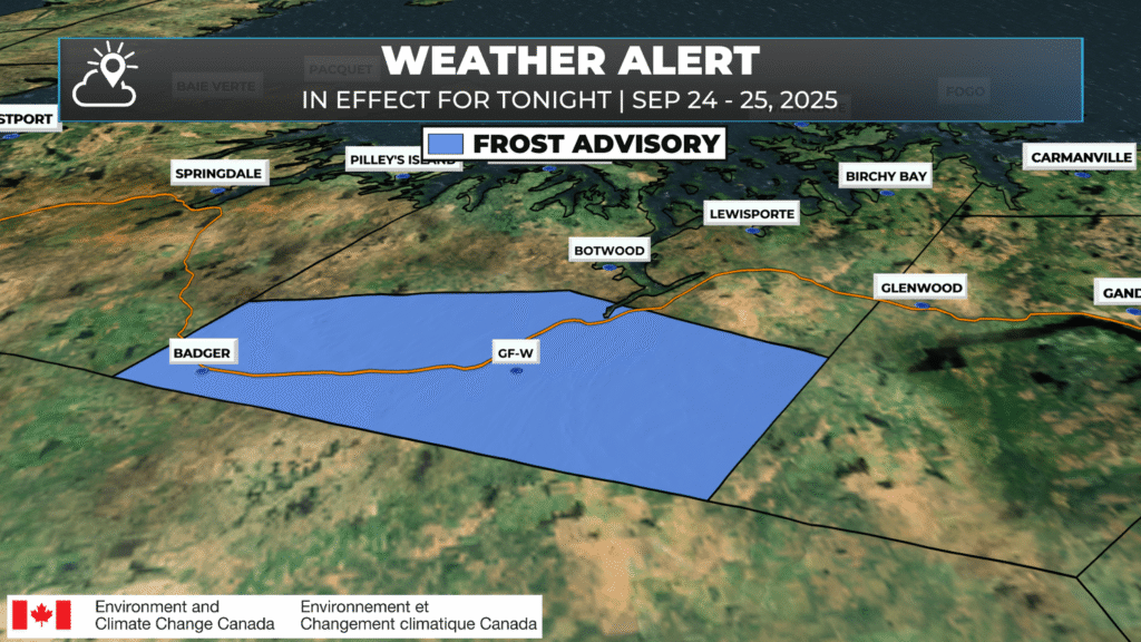
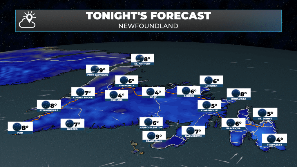
The clear skies today will persist into tonight, combining with light winds to bring a substantial drop in temperatures. A Frost Advisory is currently in effect for Grand Falls-Windsor and vicinity and will likely be expanded later today to cover more of the Island portion of the Province. If you have plants that are sensitive to the cold weather, take precautions this evening to keep them safe. Lows will be in the +1º to +5º range overnight. The best chance of frost will be centered around sunrise on Thursday.
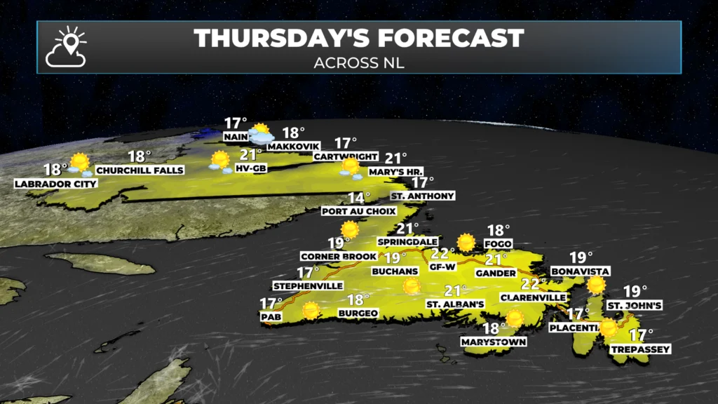
As cold as it will be tonight, tomorrow will see a rebound in temperatures back to the middle and upper teens and even some lower 20s across the Province. Some new records may be set, and St. John’s may add another 20º day to the stockpile this year. If that does occur, it would be the 82nd day in 2025!
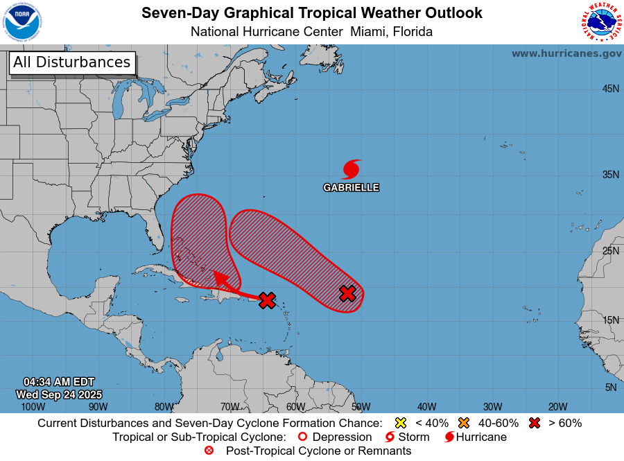
The tropics are still very active this morning. Along with Hurricane Gabrielle, there are two areas of likely development near the Caribbean Sea. These areas require close monitoring, and if you plan to visit Florida in the next week or two, paying attention to them is crucial. I’ll have a more detailed update on the tropics, along with NL’s forecasts for the rest of the week, this afternoon. Check back for updates and be sure to get the Sheerr Weather app if you don’t have it already! Also, don’t forget to subscribe to my YouTube channel to get ALL my latest forecast videos!
Good morning Eddie, thanks for weather update.
Good morning Eddie. Have a great day, and thank you for the weather info.
Good Wednesday morning to you Eddie. Thank you
Thanks Eddie.