
Tuesday Morning Weather Brief — October 7. 2025
Good Tuesday morning!
Forecasts, alerts & live weather for Newfoundland and Labrador
Good Tuesday morning!
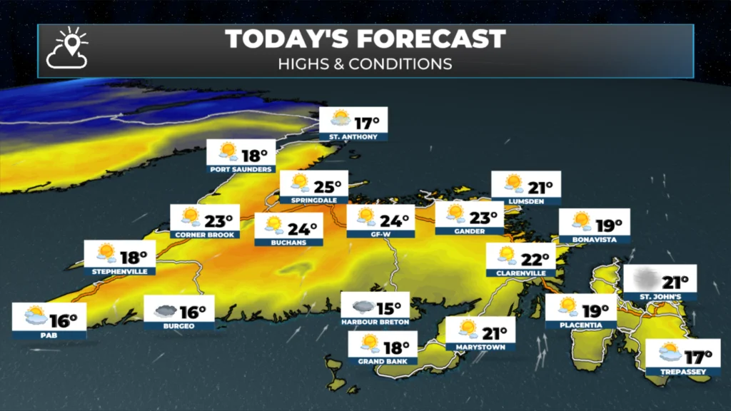
We are starting off the day much warmer on the Island today compared to yesterday. Temperatures at this hour (just before 6 AM) are mostly in the lower teens. To put that into perspective, the average high this time of year is only in the mid-teens for most of Newfoundland. Today is going to be unseasonably warm! Highs will reach the teens and 20s. Daily records are likely to tumble once more today. I’ll try and get those posted as soon as I can.
Meanwhile, in Labrador, as you can see, temperatures in the north and west are in the single digits this morning, while areas farther east and south are still in the teens. Multiple daily and monthly records fell yesterday throughout the Big Land.
=NEW MONTHLY RECORDS= Very warm Monday in #Labrador, with several locations setting new October extreme maximum temperature records. 📈 Nain auto station WFP peaked at 25.0°C – just 1.1°C short of the October record for all of Labrador (26.1°C at Mary's Hr, Oct 7, 2023). 🌡️ #nlwx
— Rodney Barney (@rcbstormpost.bsky.social) 6 October 2025 at 21:41
[image or embed]
A cold front is essentially bisecting the large landmass this morning. To the north, it’s cooler, and to the south, it’s warmer. That front is going to act as the focusing mechanism for showers and rain today.

Temperatures in the northern and western sides of the Big Land will hold in the single digits today, while in the southeast, highs will once again reach the middle to upper teens. The cold front will become stationary, which means that this pattern may hold into tomorrow, at which point the cold front will again begin moving toward the southeast.
This morning’s update is sponsored by Roebothan, McKay, and Marshall.

Visit MakeTheCall.ca to learn more about what the law firm can do for you.
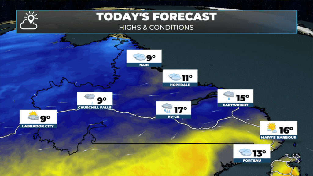
As for the timing of the rain, Future Radar and Satellite will provide accurate forecasts for you. This should give you an idea of what to expect the rain to develop this afternoon from near the Churchill Valley to Cartwright. Additionally, once the cold front passes, temperatures are expected to drop. So even though HV-GB is showing a high of 17º, it’ll likely be much cooler than that this afternoon.
Tropical Update
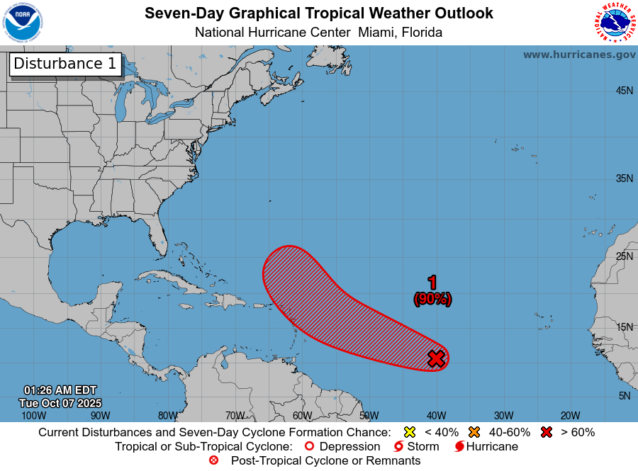
The tropics are not exactly busy this morning, but neither are they quiet. I am still monitoring one area of low pressure that the NHC (National Hurricane Center) is giving a high chance of development within the next 2 to 5 days. If this system they’re watching does get a name, it will be Jerry.
Regional Outlook
Across the rest of Atlantic Canada today, there is not much happening. Most of the rain will be confined to Quebec and Labrador, while Newfoundland and the Maritime Provinces are expected to have a sunny and unusually warm day. There may be some fog in the Bay of Fundy and in parts of western Nova Scotia.
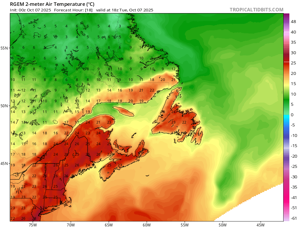
Today’s high temperatures across the region.
Have a great Tuesday! My next update will be posted this afternoon!
By using this website, you agree to our use of cookies. We use cookies to provide you with a great experience and to help our website run effectively. Privacy Policy
Good morning Eddie, thanks for weather update..
Thanks for the update Eddie! Always enjoyed your take on the weather
Good morning Eddie and thanks for keeping us updated
Good morning Eddie ! Thanks for the update….
Thank you! Very timely and informative.
Thanks for the update, looks like a nice warm day!