
Thursday Morning Weather Brief — October 23, 2025
Good Thursday morning! Here are today’s weather highlights:
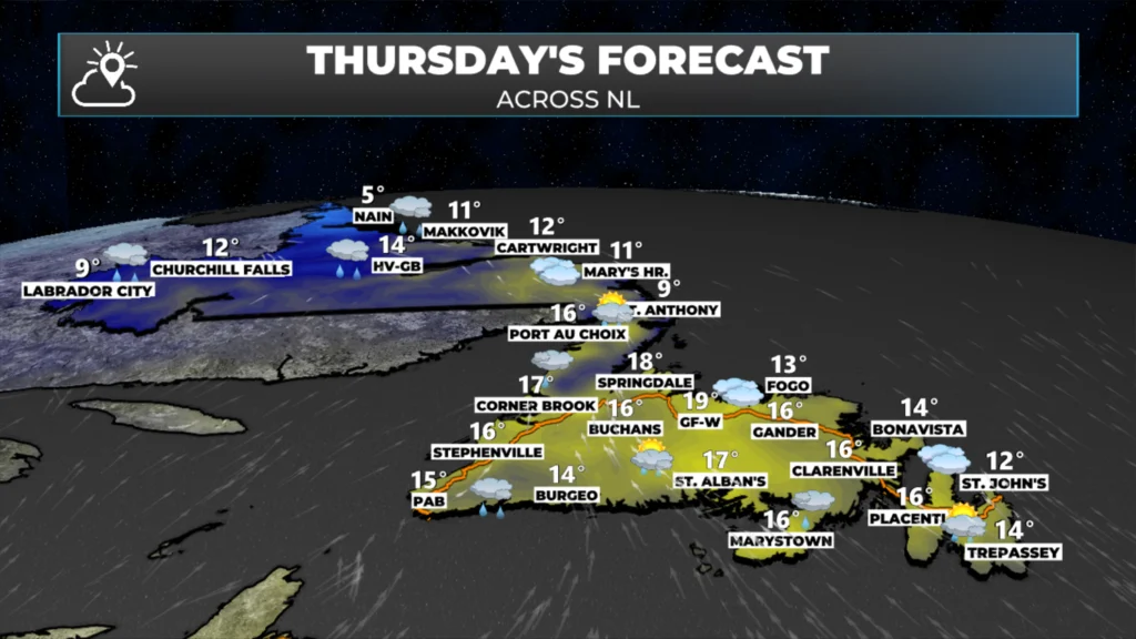
Temperatures will again be unseasonably warm across the Province, with highs in the teens for most areas (again).
An area of low pressure spinning in Quebec will bring rain and showers to much of the Province today.
Areas of dense fog will be found along and near south-facing shores.
Rain will fall in much of Labrador today, while southern and eastern areas of the Island will see it later today. Showers are expected for most areas throughout the day.
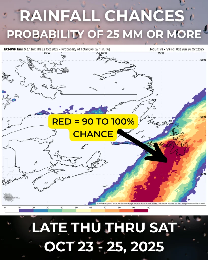
Heavy rain is likely on the Avalon and some adjacent areas of eastern Newfoundland from later today through Saturday. Computer guidance suggests there is a strong likelihood of more than 25 mm of rain.
This morning’s update is sponsored by Roebothan, McKay, Marshall.

Visit MakeTheCall.ca today to find out what the law firm can do for you!
An area of low pressure spinning over eastern Quebec is going to bring another day of mild temperatures, areas of rain and showers, and dense fog along our south-facing shores. The best chance of rain today will be throughout Labrador, and along Newfoundland’s South Coast, Burin, and Avalon Peninsulas. The best chance of rain will be this afternoon on the Island. Rainfall amounts for most areas that see it will be in the 5 to 10 mm range, with locally higher amounts possible.
There is a very high chance that the Avalon Peninsula and some adjacent areas of eastern Newfoundland will experience heavy rainfall from later today or this evening through Friday and into Saturday. Computer guidance suggests there is a very high chance of rainfall amounts of 25 mm (or more) on the Avlaon Peninsula, with a high chance of more than 50 mm in some areas (mainly south). The forecast for this event will become a bit clearer later today, but one thing is certain… it finally looks like this area will get some much-needed rainfall! Updates on this to come later today!
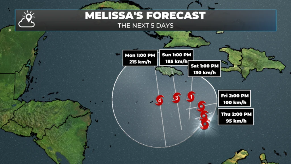
Tropical Storm Melissa continues to swirl in the Atlantic between the ABC Islands and Hispaniola this morning. The storm is forecast to become a hurricane by the weekend and possibly a major hurricane by early next week. Current projections indicate the storm will remain close enough to the Dominican Republic, Haiti, and Jamaica that weather impacts are likely in this region through the time frame. If you have travel plans to this area, especially Jamaica, over the weekend and next week, be sure to closely monitor upcoming forecasts. I’ll try to have updates throughout the day.
I’ll have my next update posted later today or Friday morning.
📱 Get the Sheerr Weather App in the Apple App Store and Google Play Store.
🗺️ Check out the Map Room to see all the latest weather observations for the Province.
🎥 Check out the Provincial Highway Cams to see 👀 what’s going on around our highways and byways!
Good morning, thanks for the update
Good Morning! Thanks for the update
You’re awesome Eddie.
Thanks Eddie for weather update
Good morning Eddie. Hope it’s sunny where you are. Thanks for the weather update.
Pauline
Thank you Eddie for for keeping us updated and for all the lovely weather . Enjoy your cruise, stay safe..