
Wednesday Morning Weather Brief — November 5, 2025
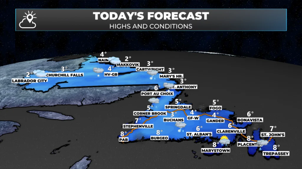
Good Wednesday morning!
The area of low pressure that passed over the Island last night and brought significant amounts of rain and snow, extremely high wind speeds, large waves, pounding surf, and storm surge has moved north of Newfoundland. The pressure in the centre of the storm has risen, but it’s still a beast.

Although the low has moved north, we are still experiencing high wind speeds this morning. Many areas from Green Bay – White Bay to the Avalon Peninsula are still seeing gusts near 100 km/h. The good news is that is extremely high wind speeds we saw yesterday over the southern Avalon have dissipated.
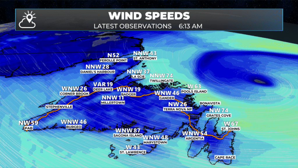
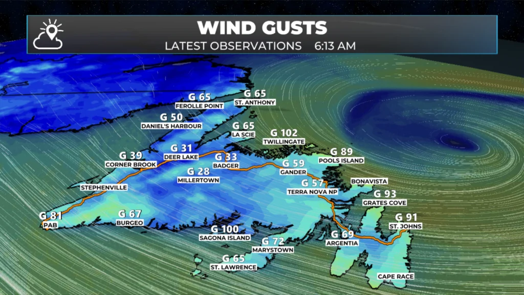
As of this hour, Wind Warnings are still in effect for many areas of coastal Newfoundland, and those will likely be in effect through much of the day, as the wind speeds aren’t forecast to come down noticeably until this evening or early Thursday.
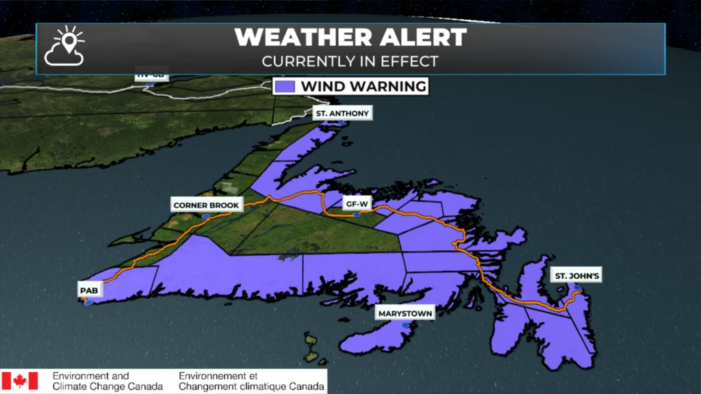
Wind Warnings for today (November 5, 2025).
The animation below shows how wind speeds decrease throughout the day over the Island. Coastal Labrador will experience increased wind speeds later today and tomorrow (not shown in this animation).
Coastal Flood Statements and Storm Surge Warnings remain in effect at this hour, and for the north-facing shores of Newfoundland and coastal Labrador, these alerts will remain in effect through late Thursday or Friday morning. Coastal flooding is possible in the warned areas. Be sure to check for updates on the alerts. Southern areas of Newfoundland are also still under a Storm Surge Warning at this time, which will likely be ended after this morning’s high tide.
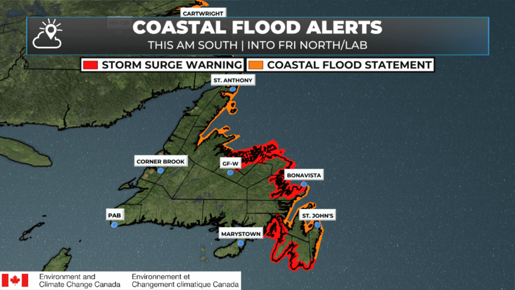
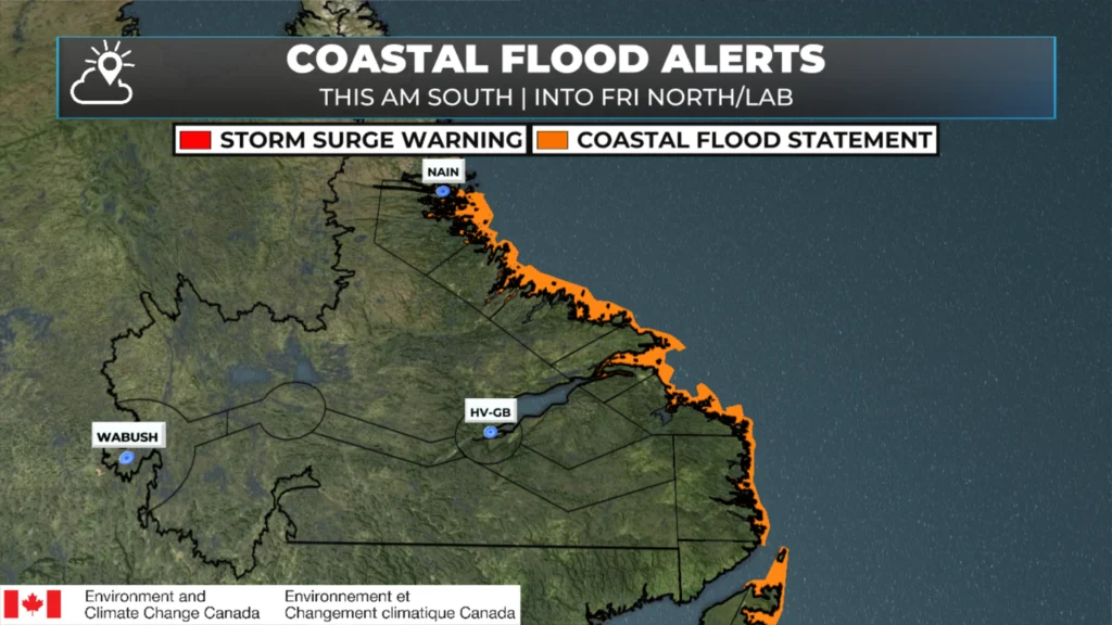
I’ve heard rumours that there was storm surge flooding in parts of the southern and southeast Avalon Peninsula last night. I also received some video of minor flooding in the Gambo area of Bonavista Bay last evening. As day breaks, I’m sure damage will be confirmed in the south… it’s a question of where and how bad. The waves were large, and just offshore of St. John’s Harbour, a buoy measured a maximum wave height of over 10 metres last evening.
The buoy outside of St. John's Harbour measured a max wave height of 10.4 (34 feet) metres last evening (Nov 4, 2025)! #nlwx pic.twitter.com/xNhXHWEkKW
— Eddie Sheerr (@EddieSheerr) November 5, 2025
Good Wednesday morning ☕️Eddie….We have high winds & rain in the Corner Brook area this morning!…Stay safe & enjoy your day!
Thanks Eddie for weather update, really bad out this morning, high winds.
Wow that was an eventful day and night. Thanks for keeping us so informed through it
Thank you for keeping us informed Eddie! You are exceptional!
Love the crisp displays … I was curious how our coastal ‘ribbon’ regions were showing up in some of the maps – they look good! A busy week this has been.
Still very windy on Bell island. Not as bad as last night though. Thanks Eddy for all your updates and knowledge.
Still windy here in Grandbank