The weather across the Island is calmer this morning than it’s been for the last several days, and that’s not a bad thing! Our intense area of low pressure has moved far enough away that we are no longer under its influence like we were yesterday. The animation below shows that well.
You’ll notice there is one circulation north and east of Newfoundland and Labrador, that’s the low from yesterday. Also, notice a second circulation over western Nova Scotia? That’s the next low-pressure centre that will spread rain and snow across southern and eastern Newfoundland starting this afternoon.
Visit MakeTheCall.ca to learn more about what the law firm can do for you.
There is a bit of uncertainty with this system… not so much with respect to the arrival and temperature but more to do with precipitation type. Temperatures inland and over higher terrain of southern and eastern Newfoundland, west of the Avalon, should be just cold enough to support wet snow or a mix of rain and wet snow. Along the coast, most of what falls should be rain. The animation above shows that well.
On the Avalon, the precipitation will start as rain, but I think that as the low deepens and begins to pull away, enough cold air will be involved for most areas to change to snow this evening, after initially starting as rain. I’m unsure if there will be much accumulation, but if there is, it will be a couple of centimeters on grassy/unpaved surfaces.
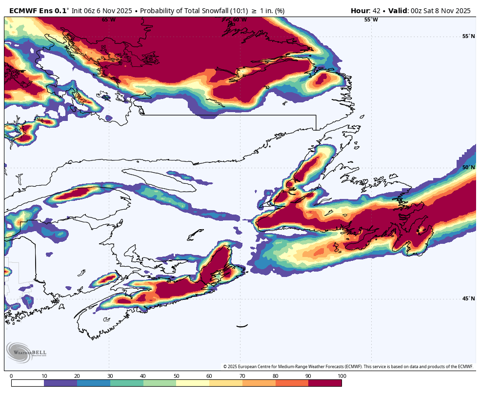
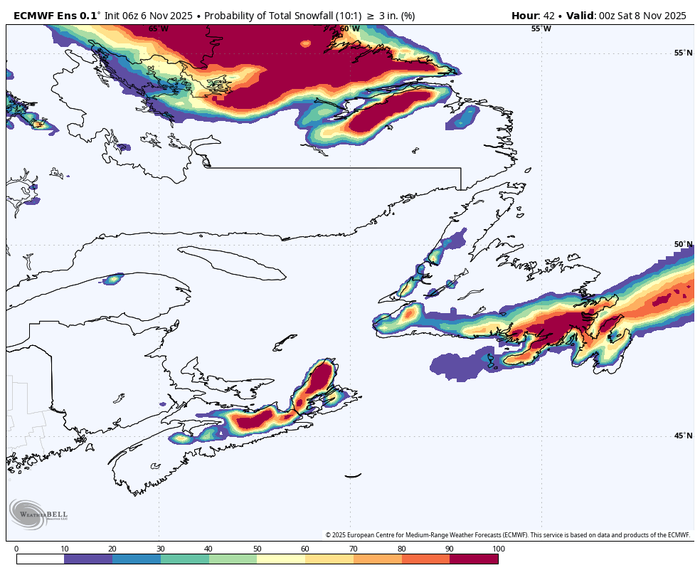
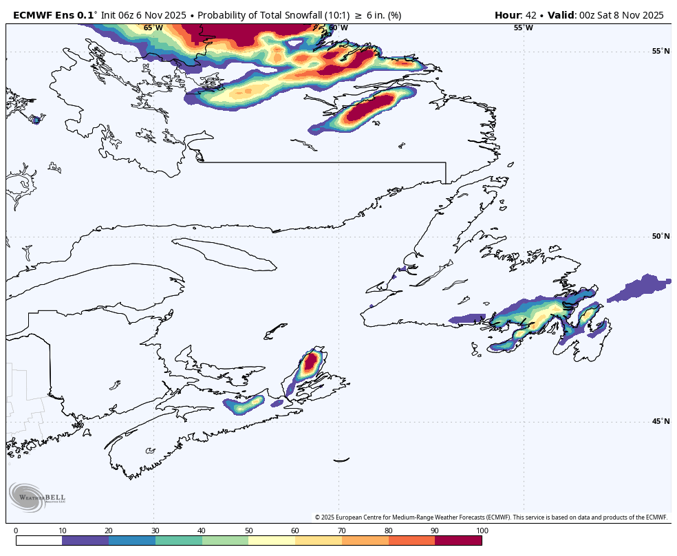
The images below show the chances of 2 cm, 9 cm, and 15 cm of snow. The brighter the colour, the higher the chance. Something of note is that the computer calculated the snow at being at a 10:1 ratio, meaning for every 1 cm of liquid you’ll get 10 cm of snow. The ratio will be lower than that, meaning the guidance is a good indicator of where it could snow decently, but the amounts aren’t overly accurate in this instance.
This round of rain and snow will also be accompanied by another bout of gusty winds. However, the peak should be in the 80 to 100 km/h range and not any higher than that. The animation below times out the arrival and departure of the icy gusty wind speeds. Speeds will be highest on the Avalon towards the end of the event as the low-pressure system pulls away from the area.
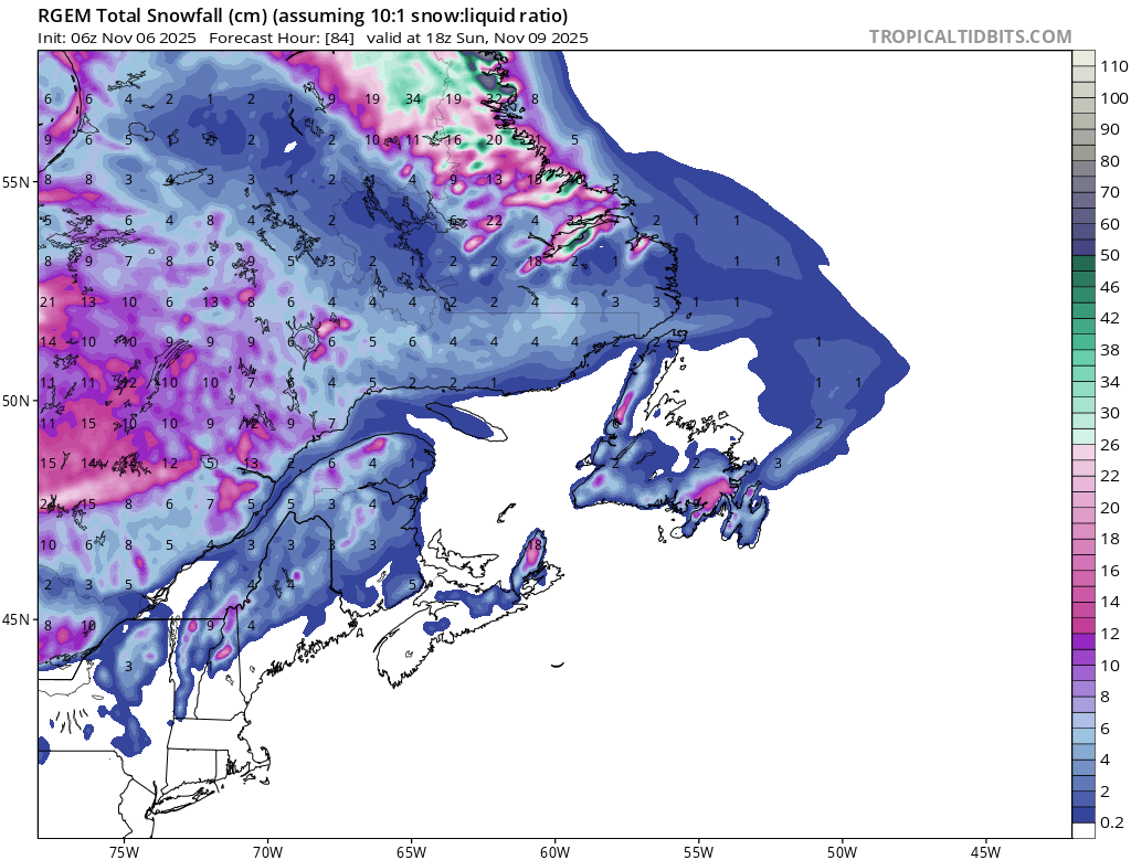
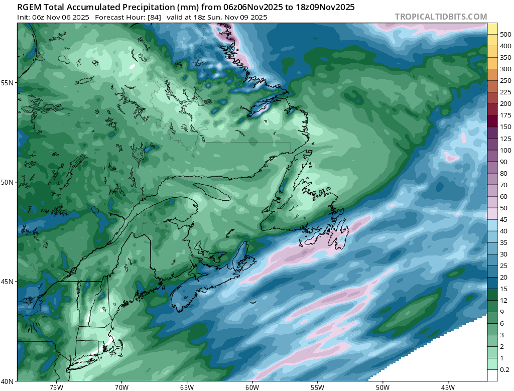
Coastal Labrador will see significant amounts of coastl rain and snow and mountain snow over the next few days. The images below give you an idea of what to expect. On top of that it will be breezy with the potential for storm surge in some areas. Flying into and out of the coast will be challenging for the next few days.
Eddie, I really appreciate your weather updates. They are well done! I saw the amazing statistics on the wind during Tuesday’s storm, but haven’t seen any statistics on rainfall from that storm. Here in CBS we had roughly 80 mm from early Tuesday until late Wednesday.
⚠ Storm ModeGet warnings pushed to your phone the moment they’re issued.Get the app
By using this website, you agree to our use of cookies. We use cookies to provide you with a great experience and to help our website run effectively. Privacy Policy



Oh my’. I’m so not ready for the ‘S’ word. Thank you Eddie for your detailed weather forecast. Like it or not, we’ve been warned!!! Have a good day
Hi Eddy, is the wind animation for this morning’s forecast correct, it says Wednesday?
Amazing weather report.The animation is so cool.You are a fantastic dad & meteorologist 😘
Good morning Eddie, thanks for weather update.
Thanks for the update! The older I get the more I dislike winter! It is what it is! Have a great day Eddie!
Eddie, I really appreciate your weather updates. They are well done!
I saw the amazing statistics on the wind during Tuesday’s storm, but haven’t seen any statistics on rainfall from that storm. Here in CBS we had roughly 80 mm from early Tuesday until late Wednesday.
whats the weather gonna be looking like for Deer Lake area on friday?