
Friday Morning Weather Brief — November 14, 2025
Good Friday morning!
I’m a little late getting started this morning. Apologies!
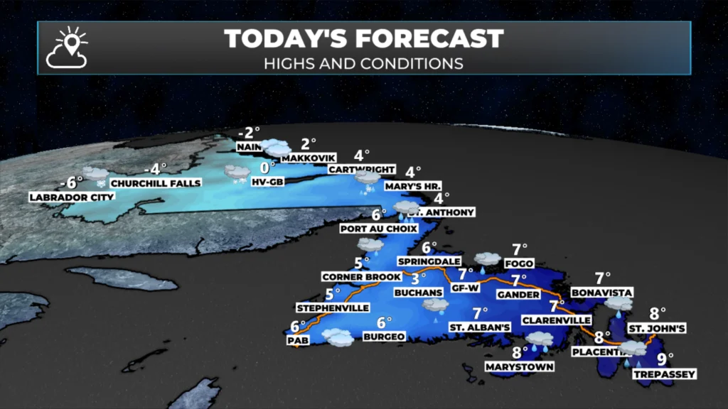
The heavy rain that fell over much of the Island last night has moved off to the west. The highway cameras across the Island suggest that most of what fell did fall as rain. The only area I see snow on the ground is on the Corner Brook camera. Simulated radar imagery (loop below) shows the majority of the precipitation is now falling over western Newfoundland and into Labrador.
That area of rain and snow will continue pushing back to the west. The rain and snow from this round will end on the Island late morning or early afternoon, but will continue in Labrador through much of the day. The next low moves into eastern Newfoundland this afternoon on this one’s heels.

This morning’s update is sponsored by Roebothan, McKay, Marshall.
MakeTheCall.ca
Much like yesterday, the rain from our next low will arrive on the Avalon during the late afternoon or early evening, in time for the commute home and supper hour. And much like yesterday, the rain will be heavy for a couple of hours as the low quickly moves through. As the low moves back to the west, the intense rainfall will ease, but light rain and showers will continue into the overnight and early Saturday morning. Much of the Island will see more rain overnight into early Saturday. The low-pressure system is expected to push back into Labrador on Saturday, bringing additional rain and snow to the Big Land. Future radar and satellite data provide a clear picture.
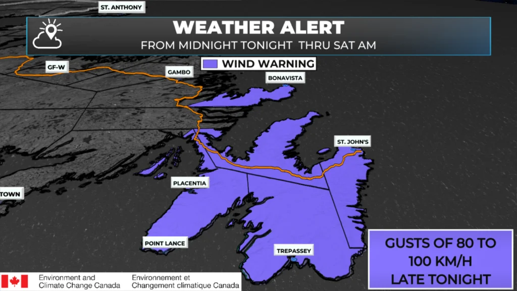
This low will also have a core of high wind around it as it moves into the Avalon and Bonavista Peninsulas late this evening and tonight. It appears that much of this area will experience a two- to four-hour period, centered around midnight, of wind gusts between 90 and 110 km/h. A Wind Warning has been issued for the Avalon and Bonavista Peninsulas for tonight ahead of the incoming wind.
I’ll have my next update for you this afternoon. Have a great day!
I’ll have my next update posted over the weekend.
📱 Get the Sheerr Weather App in the Apple App Store and Google Play Store.
🗺️ Check out the Map Room to see all the latest weather observations for the Province.
🎥 Check out the Provincial Highway Cams to see 👀 what’s going on around our highways and byways!
Thanks Eddie for weather update
Thanks Eddie for the update, have a great day
Thanks for the update..
Wind gusts tonight …. Direction?
Thanks Eddie! Your weather updates are appreciated.
Thanks Eddie for always giving us
Updates on the weather!
Thanks Eddie for the updates.👍👍
Thanks Eddie have a great day
None of the other weather app’s have notifications spoofing Eminem 😂👍🏻 loving the app and your weather briefings