
Wednesday Morning’s Weather Update — November 26, 2025
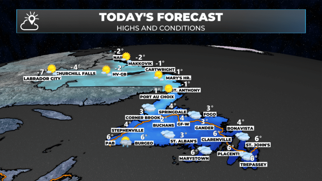
The forecast for today, November 26, 2025
Good Wednesday morning!
The day is starting generally quietly across the Province, with a few showers and/or flurries over western and southern sections of the Island. Temperatures are or below freezing on the Island and well below in Labrador. Some areas of the Big Land, particularly in the west, are near -10ºC. Temperatures on the Island today recover to the single digits above freezing everywhere except the Northern Peninsula — where highs will be near 0ºC. Labrador will see highs of -4ºC to -10ºC. The cooler readings will be found in the west.

Skies will start partly cloudy to mostly sunny on the Island; however, clouds will increase this afternoon from south to north as our next weather-maker approaches from the southwest. Meanwhile, Labrador will see sunny skies throughout the day under a ridge of high pressure.

This morning’s update is sponsored by Roebothan, McKay, Marshall.
MakeTheCall.ca
As our next low-pressure centre begins to roll in, rain and showers will arrive over the southern and eastern parts of the Island later this afternoon or this evening. There will likely be some pockets of snow tonight just inland from the south coast, over the higher terrain. Outside of that, the weather across the Province looks fairly quiet overnight.
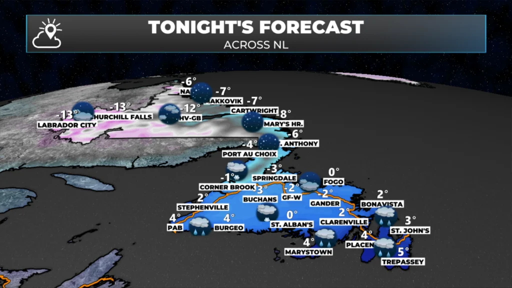
Thursday will be a much more active day across the region as an area of low pressure tracks into Quebec. This track means the Island will see rain, as it’s on the warm side of the system, and Labrador will see more snow, on the colder side of the low. The rain will fall throughout much of the day on the Island, while the snow will hold off in Labrador until the afternoon. The Northern Peninsula will likely see snow Thursday, changing to freezing rain and eventually rain… but this is the one area on the Island that will see an extended period of wintry weather from this system. The animation below shows this well.
The rain will ease on the Island by Friday morning, but the snow will continue in Labrador. In fact, in some coastal areas, the snow may linger into the weekend. This will be a significant snow producer, and the map below shows the snowfall forecast from early Wednesday through Sunday. Some areas will see over 50 cm. Some of the higher terrain in western Newfoundland will also see significant snow over the next several days, after Thursday.
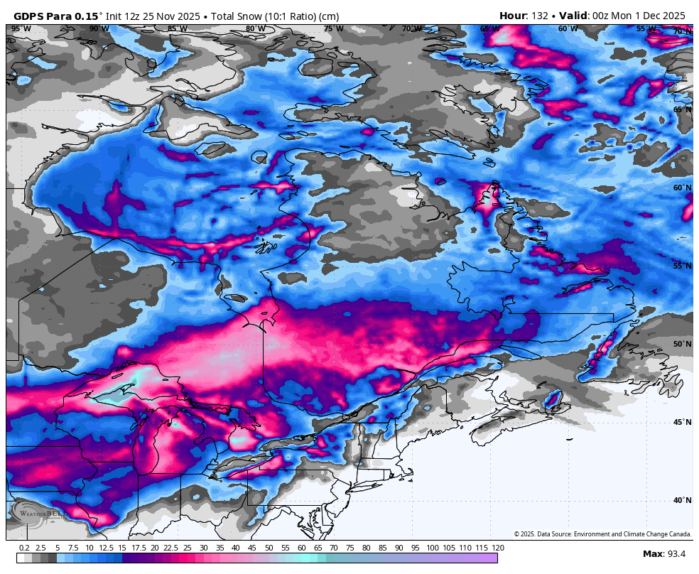
The snowfall forecast through Sunday evening, November 30, 2025 @ 8:30 PM NST.
My next update will be posted this afternoon.
Stay tuned!
I’ll have my next update posted later today!
📱 Get the Sheerr Weather App in the Apple App Store and Google Play Store.
🗺️ Check out the Map Room to see all the latest weather observations for the Province.
🎥 Check out the Provincial Highway Cams to see 👀 what’s going on around our highways and byways!
Thanks for weather update Eddie
Had our first light dusting of snow overnight in Upper Island Cove. If only it would stay this way. ….. wishful thinking on my part.
Thanks Eddie