
Thursday Morning Weather Update — December 18, 2025
Good Thursday morning!
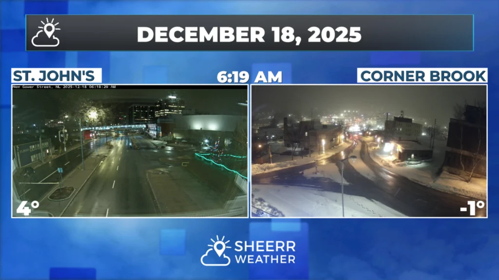
A cold front is currently moving across the island. Ahead of the front, we are experiencing mild temperatures and rain showers, while it’s colder behind the front with areas of flurries and light snow. The rain is mainly over the eastern parts of the island, and the snow has started in the west. The image (above) showing Corner Brook and St. John’s illustrates this well. The radar gif (below) provides a good idea of what’s happening right now.
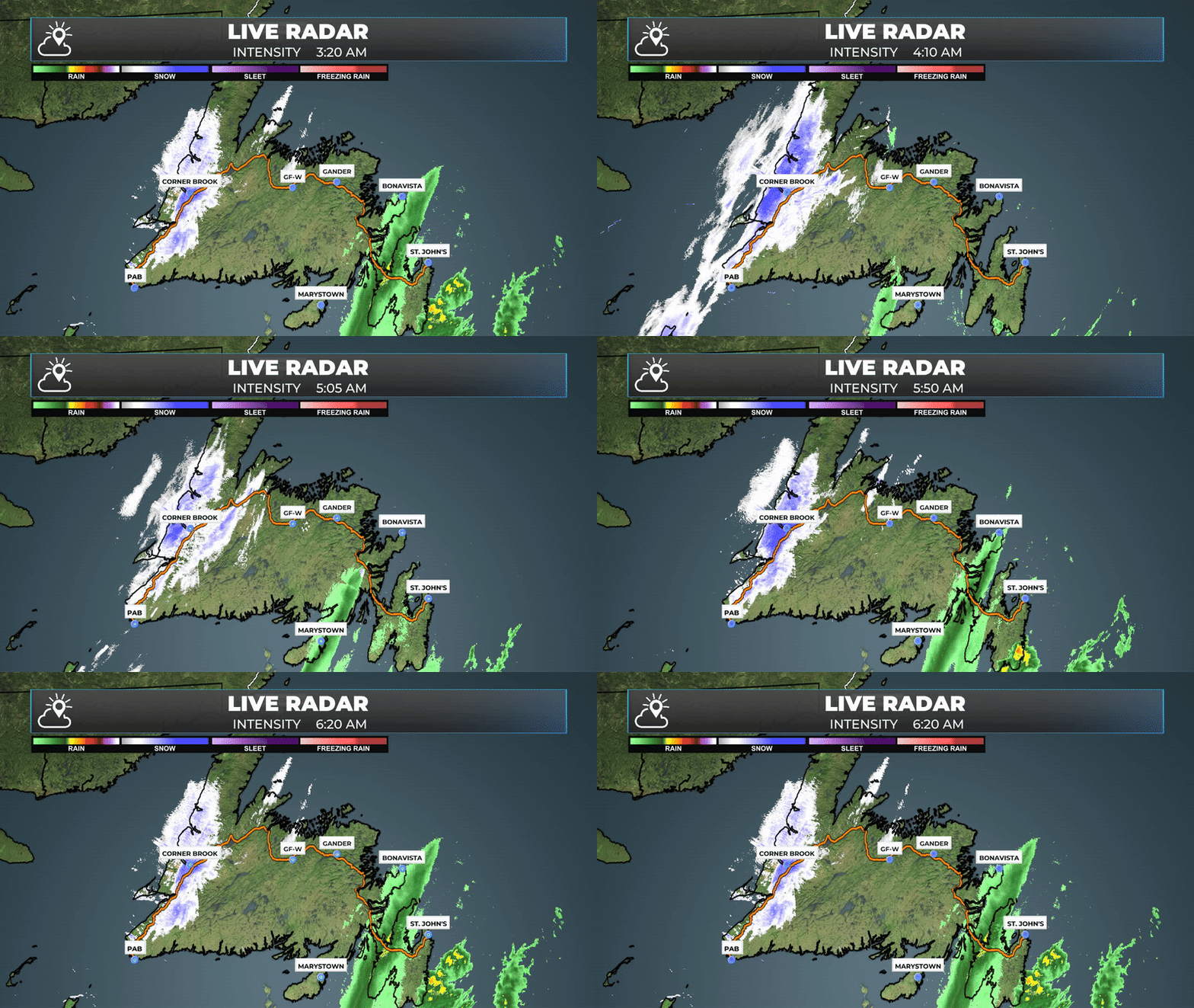
The colder air we are seeing in the west will eventually work its way to the east… which means the mild temperatures we are seeing now over eastern sections of the Island will be erased as temperatures fall through the remainder of the day.
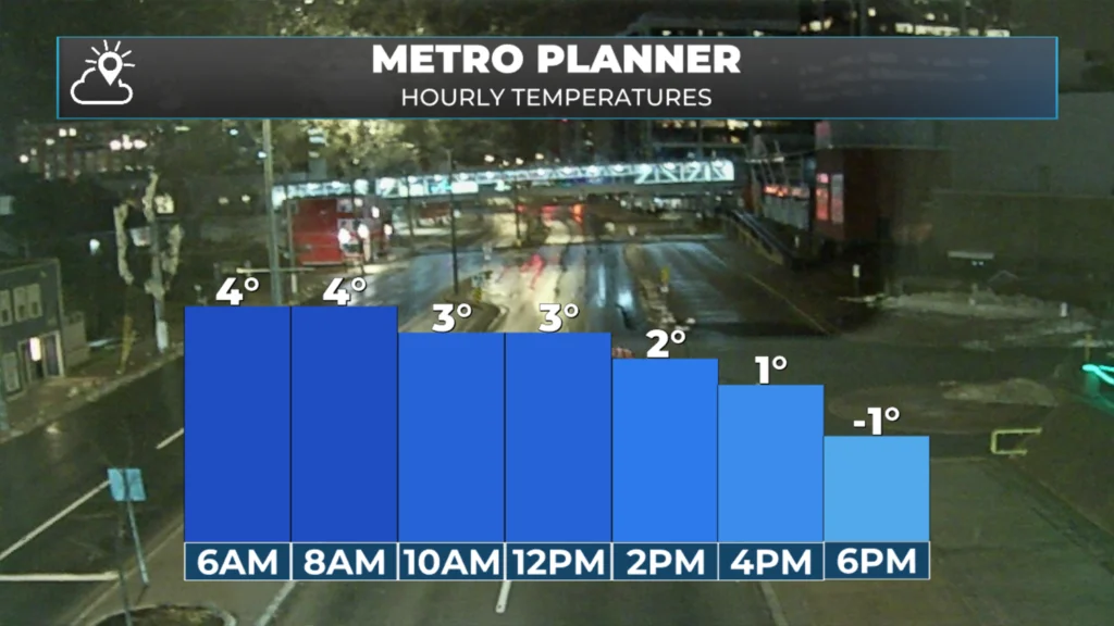
Today’s hourly temperatures for the St. John’s Metro area.

On the plus side, it should be sunny for most areas today. Although wind chills will be a bit lower than the advertised temperatures.
That sunshine will not last, however, as our next weather maker has its sights set on NL. This one will bring unseasonably warm temperatures for tomorrow and Saturday.

This update is sponsored by Roebothan, McKay, Marshall.
Visit MakeTheCall.ca TODAY to learn more about what the law firm can do for you.
Significant snowmelt is expected due to the warm nature of the incoming storm system. Any low that cuts into Labrador will often bring a surge of warm air with it, and this will be no exception to the rule. In advance, Environment Canada has issued Special Weather Statements for Newfoundland and Labrador.
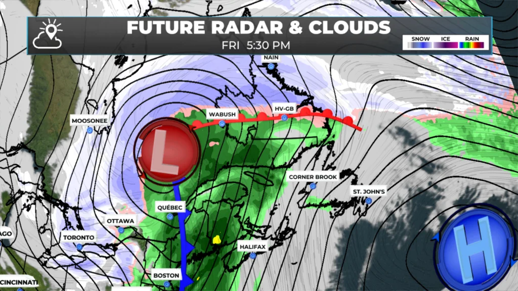
There are some finer details to get into about the incoming system and I’ll have those for you this afternoon.
I’ll have my next update posted later today!
📱 Get the Sheerr Weather App in the Apple App Store and Google Play Store.
🗺️ Check out the Map Room to see all the latest weather observations for the Province.
🎥 Check out the Provincial Highway Cams to see 👀 what’s going on around our highways and
Good morning Eddie, thanks for weather update.