
Thursday Morning Update — January 15, 2026
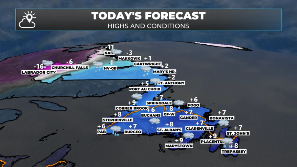
Today’s forecast – January 15, 2026
Good Thursday Morning!
Here are today’s weather highlights:
Today will be mild across Newfoundland, with rain, showers and fog patches in the south.
Snow will fly across most of Labrador, except near the Straits, where what falls will be mostly rain.
Yellow Warnings for Rainfall and Wind are in effect for various areas of Newfoundland from today into Friday (rain) and Friday into Saturday (wind).
Rain will ease tonight from system #1 across the Island, and another round of rain moves in tomorrow with system #2.
Snow eases in Labrador later today as system number #1 departs, but redevelops Friday as system #2 moves in.
Winter Storm Watch in effect for much of Labrador
Travel in the Straits of Labrador, the Northern Peninsula, and eventually on the West Coast will become troublesome Friday afternoon and evening as rain changes to freezing rain and/or snow.

This update is sponsored by Roebothan, McKay, Marshall.
Visit MakeTheCall.ca TODAY to learn more about what the law firm can do for you.
We are off to a mild start across the Island, particularly in the east and southeast, where temperatures are north of 5º for many areas. It’s a bit cooler on the West Coast and Northern Peninsula, but much of this area will see warm readings as the day progresses.
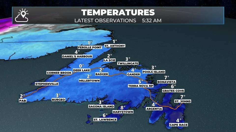
Temperatures as of 5:32 AM NST on January 15, 2026.
Meanwhile, as we begin the day in Labrador, it’s quite mild in the south, while areas north and west are still very much below the freezing mark. Temperatures will not shift much from where they are this morning in the Big Land.
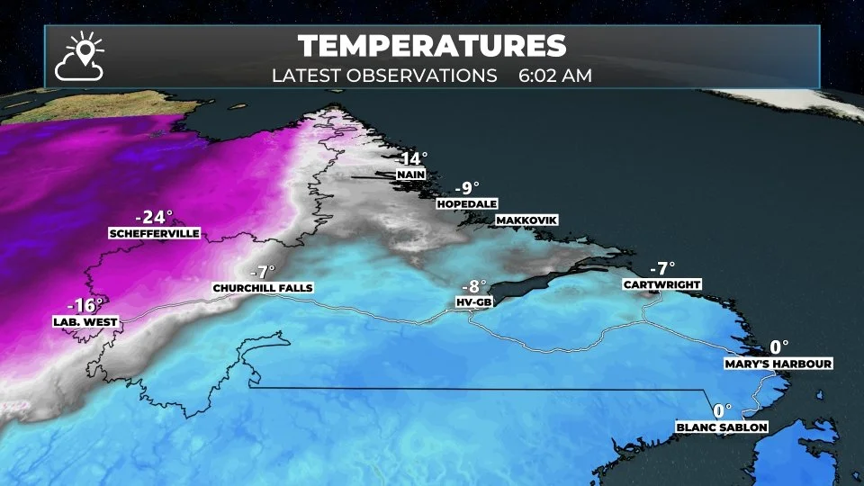
Temperatures as of 5:32 AM NST on January 15, 2026.
We are already seeing rain and snow over much of Newfoundland and Labrador this morning, and future satellite and radar show how the precipitation will play out throughout the rest of the day. Take note that it will basically rain all day on the Island and snow all day in a good chunk of Labrador. Also note how there are two very separate rounds of rain and snow over the next 48 hours or so. One today, and the second tomorrow.
Rain amounts between today and tomorrow will be significant over much of the island, and that is why there are Yellow Warnings – Rainfall currently in effect from ECCC. The highest totals will be found in the south, where some spots will see over 50 mm by the time we are all said and done.
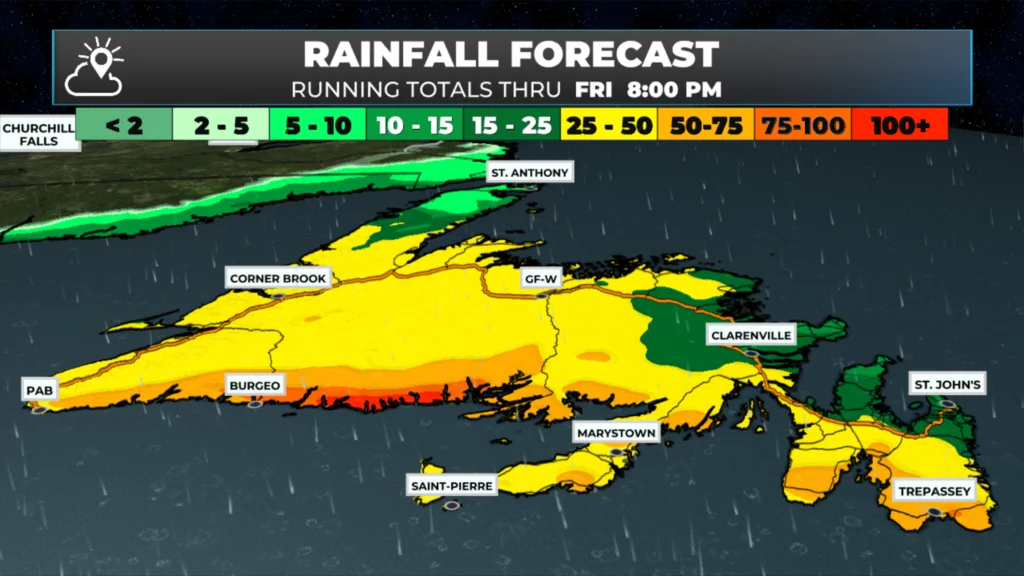
Total rainfall between 6 AM this morning and 8 PM Friday (Jan 16, 2026).
Snow amounts in Labrador will be widespread, 15 to 30 or more cm, by the time Friday night or early Saturday morning rolls around. Portions of western Newfoundland will also see some snow between Friday afternoon and Saturday, but amounts will not be nearly as high (in most areas outside the mountains) as those in Labrador.
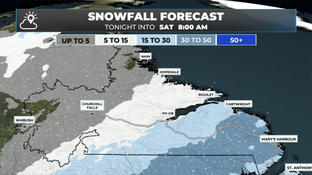
Labrador snowfall between 6 AM this morning and 8 AM Saturday (January 17, 2026).
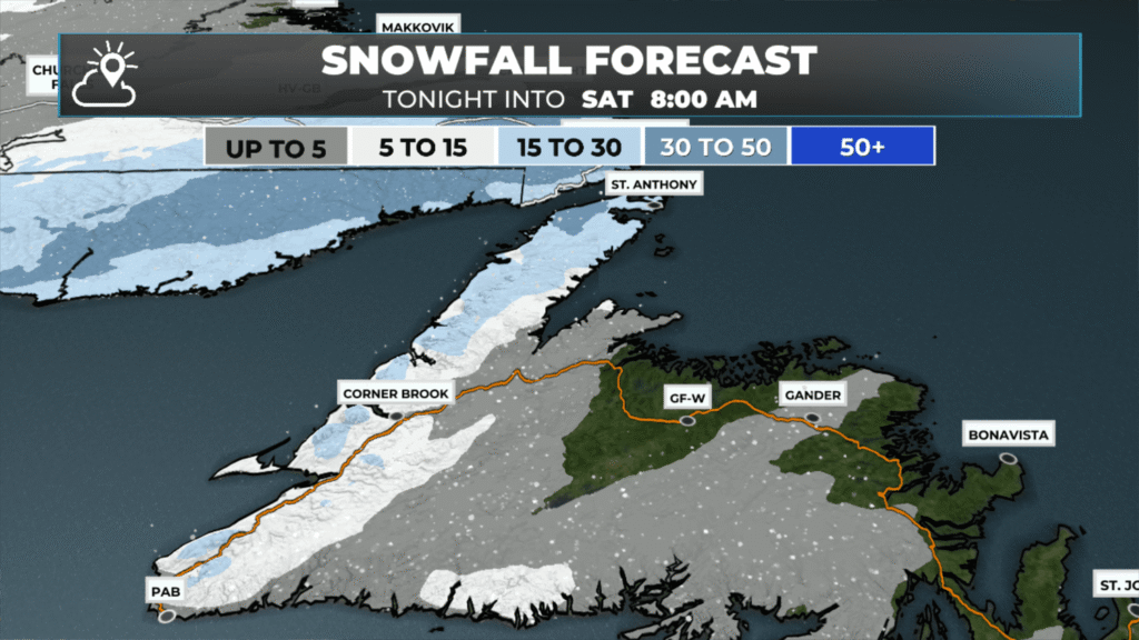
Newfoundland snowfall between Friday afternoon and 8 AM Saturday (January 17, 2026).
Updates to come throughout the day.
📱 Get the Sheerr Weather App in the Apple App Store and Google Play Store.
🗺️ Check out the Map Room to see all the latest weather observations for the Province.
🎥 Check out the Provincial Highway Cams to see 👀 what’s going on around our highways and
Good morning, thanks for the update
At least we won’t have to shovel on this end 🙂
Good Morning Eddie! Nice to see the warmer temps! Thanks for the update, enjoy your day
Love getting up to + temps. Thanks for keeping us up to date on weather events!
Thanks Eddie for weather update