
Monday Morning’s Weather Briefing — February 9, 2026
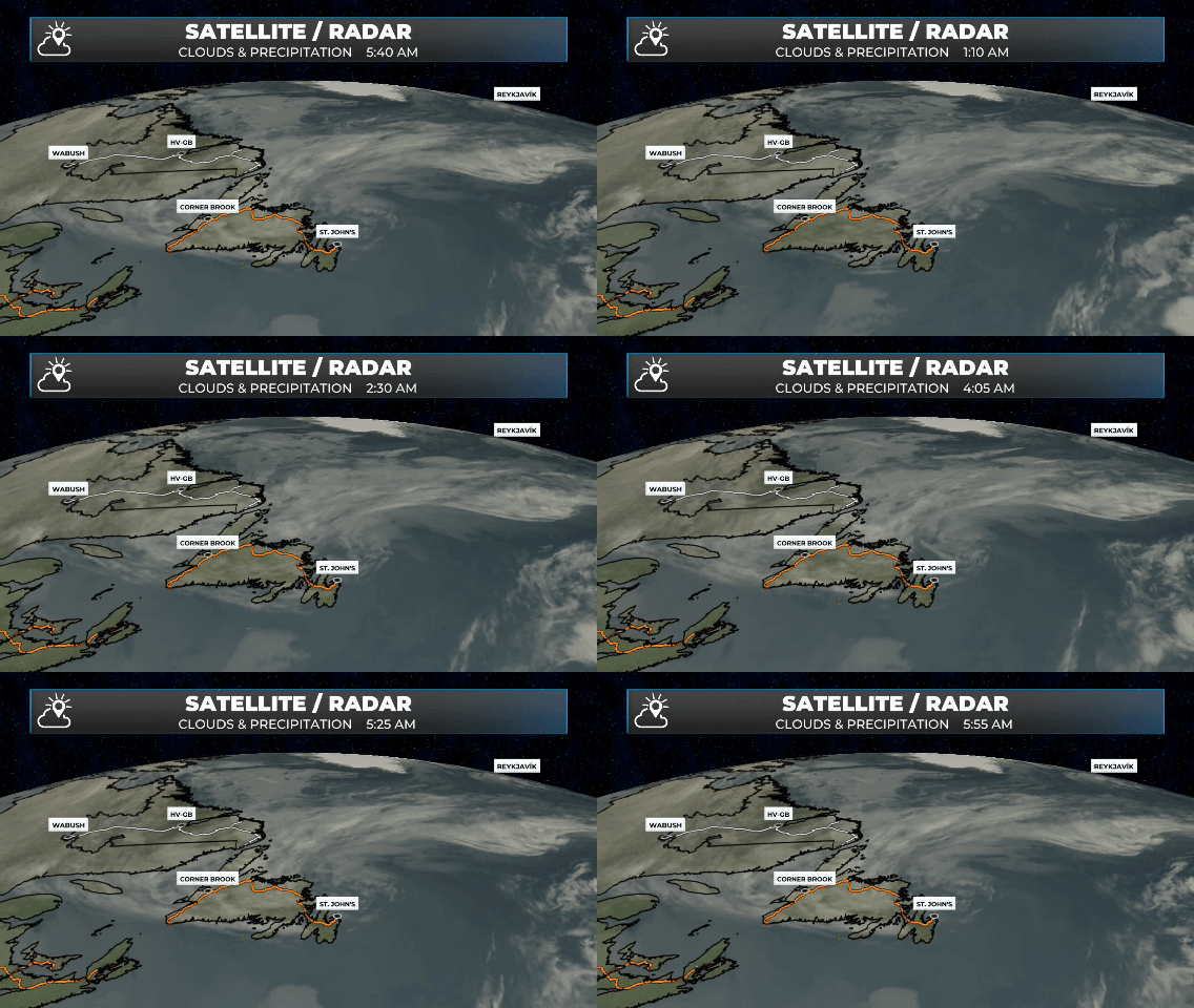
6 hour satellite and radar loop — February 9, 2026.
Good Monday Morning!
Here are today’s weather highlights:
A Yellow Level Snowfall Warning remains in effect until early Tuesday morning for Green Bay – White Bay and Bay of Exploits for up to 20 cm of snow, with locally higher amounts.
A Special Weather Statement remains in effect until later today for Red Bay to L’anse-au-Clair and Norman Bay to Lodge Bay for up to 20 cm of snow.
Snow becomes more widespread today on the Northern Peninsula, central and northeastern Newfoundland, while snow will continue over much of Labrador’s coast. The snow will mix with rain in some areas, especially on the Northern Peninsula.
Snow moves onto the Avalon tonight and will continue into much of Tuesday, while areas west will see the snow end on Tuesday. Snow on the Avalon ends Tuesday afternoon. Snowfall for the northern half of the Avalon (metro included) looks to be around 10 cm, with amounts dropping fairly sharply farther south. Inland areas over higher terrain will see more than 10 cm but less than 20 cm.
Highs near 0ºC on the Island and for much of coastal Labrador today, with Labrador West will be in the minus teens.
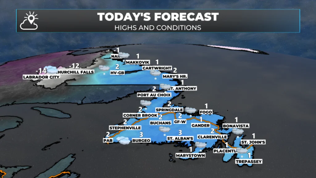
Today’s high and conditions across Newfoundland and Labrador – February 9, 2026.
Those Pesky Stalled Lows…
A very interesting weather pattern will be with us this week. An area of low pressure will remain over the North Atlantic and show virtually no eastward movement. In fact, this low, or series of lows, will actually move from east to west, or retrograde, toward Newfoundland and Labrador.
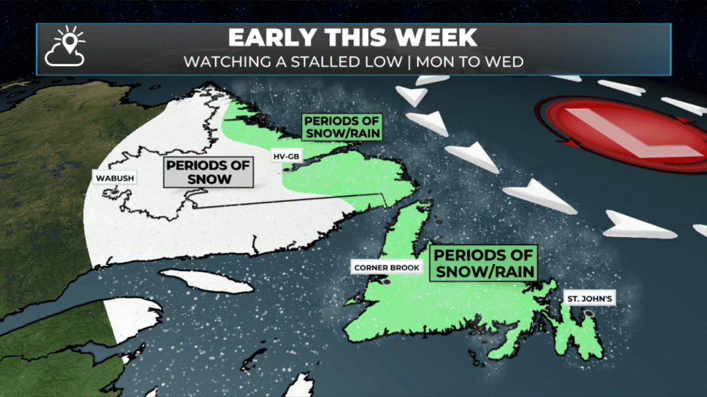
The setup through the early part of this week – February 9, 2026
This is a setup I am very familiar with, and it often brings forecast challenges and surprises; this will be no exception. The reason this pattern is so challenging is that these features are located in the middle of the ocean. When it comes to weather models, the best forecasts usually come from areas with the most data to process, and, as we know, that is not in the middle of the ocean. The result is that features are often not modelled correctly, and while I know roughly what will happen, the finer details are often not clear until they occur. I find this as frustrating as you do, but I’ve forecasted here long enough to understand that this is a scenario where forecast errors are likely to be the most significant.
As we begin the week, an initial round of snow will be along the coast of Labrador. That will ease later in the day, Monday or Monday night. Another round will move in on Wednesday and ease by Thursday morning.
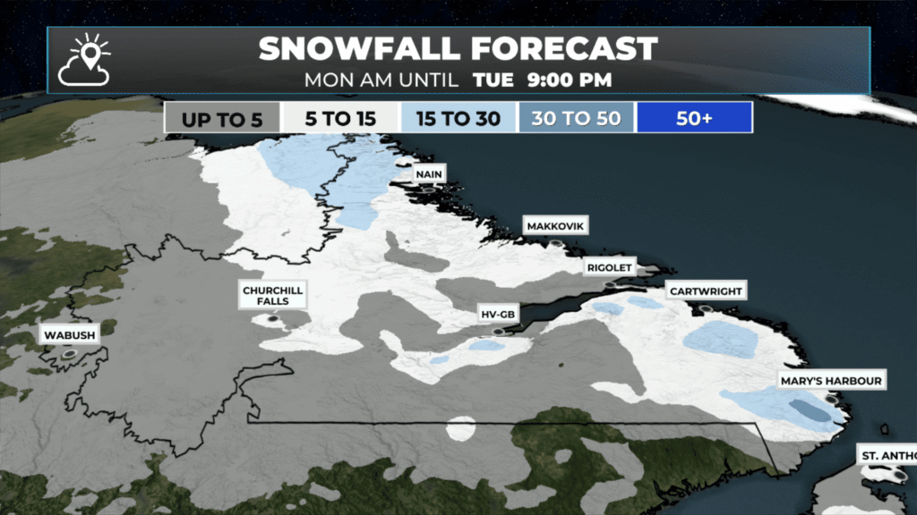
On the island, the initial round of snow will be concentrated from near Green Bay – White Bay, eastward to Fogo Island and as far south as the TCH. This is already happening tonight and will continue into Tuesday. However… this area of snow will gradually shift eastward, and Monday night and Tuesday it will be focused over northeastern Newfoundland and potentially the Avalon Peninsula before finally moving offshore Tuesday night. While the most significant snowfall will be in central areas and in Green Bay-White Bay (20+ cm), areas farther east will likely see 5 to 15 cm of snow during this period, with locally higher amounts possible. That includes the northern half of the Avalon/Metro area. Southern areas and locations that typically see less snow in onshore, northeast winds, will see less than 5 cm.
This is illustrated in the gallery of images below. You can tap on each one to expand it.
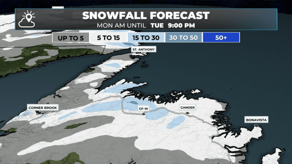
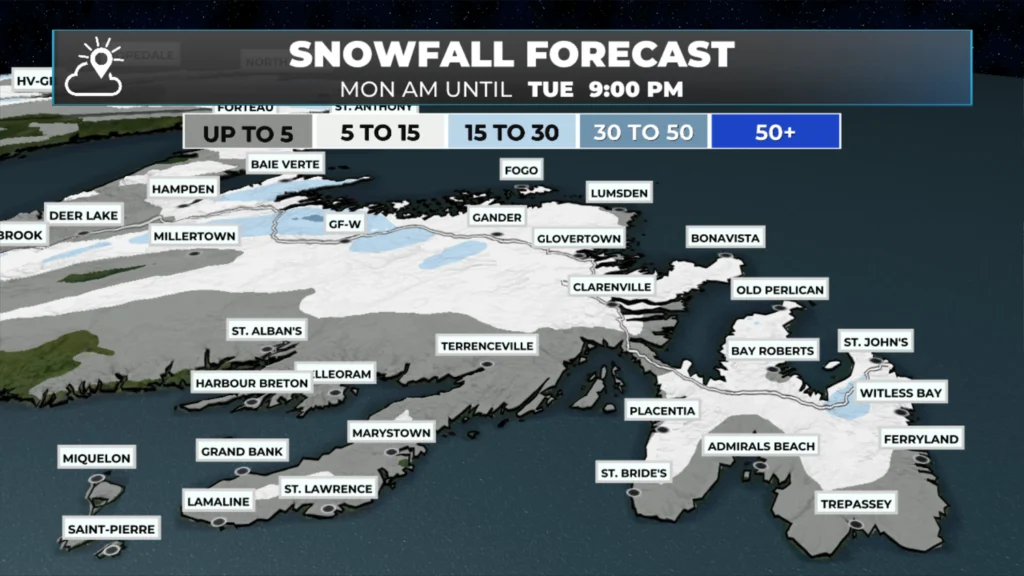
There will then be a break on Wednesday, followed by another low that could bring more snow to central and eastern Newfoundland on Thursday. This low moves in from the south and has the potential to bring more widespread significant snowfall to a large portion of central and eastern Newfoundland. And possibly some rain as well.
I’ll have updates for you throughout the day!
📱 Get the Sheerr Weather App in the Apple App Store and Google Play Store.
🗺️ Check out the Map Room to see all the latest weather observations for the Province.
🎥 Check out the Provincial Highway Cams to see 👀 what’s going on around our highways and
Tks Eddy keep up the good work.
Good morning Eddie. Thanks for the updates.
Thanks for the update Eddie. I am traveling to Central today from the West Coast. Have a great day!
Good Morning Eddie
What a length of a winter, and it’s not over yet! We’ll just have to grin and bear it. 🥴. Thanks for your updates Eddie!
Heading toward 100cm in February. I get out and enjoy! 🎿 thanks for the accurate forecasts.
Thanks for weather update Eddie
Thank you Eddie. I always know I can count on you for a reliable & accurate forecast. It is quite challenging to do here and you are doing an amazing job
Great job Eddie keep up the great work
Thanks Eddie for the update….Enjoy your day
Thanks Eddie
Commenting on the rainbow today Febuary 12 over CBS NL. Well i’m not surprised because this is Gods country. Just saying.