
Friday Morning’s Weather Briefing — February 13, 2026
Good Friday Morning!
Here are today’s weather highlights:
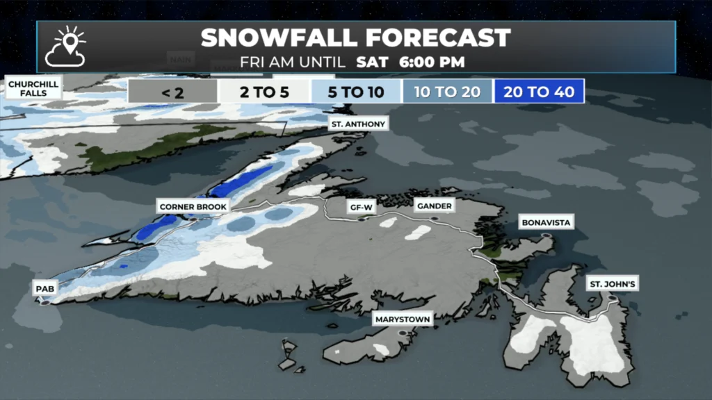
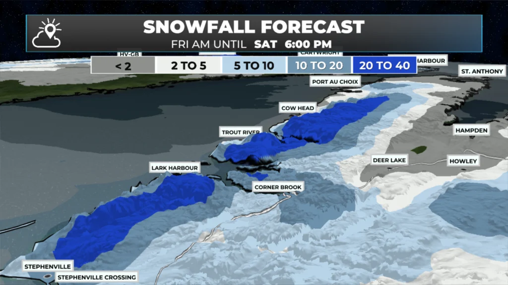
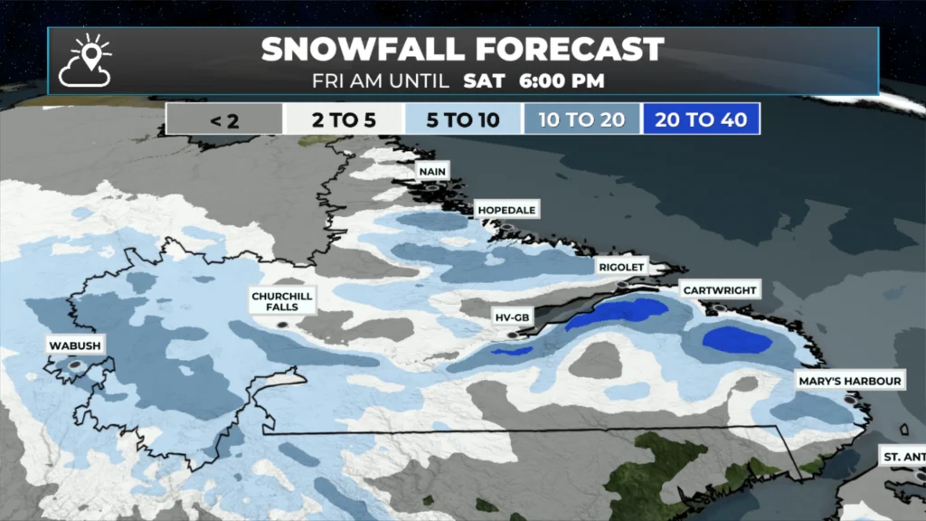
Snow will be found throughout much of Labrador, along with Newfoundland’s West Coast and the Northern Peninsula today. Areas farther east on the ISland can expect scattered flurries.
Yellow Level Alerts for Snowfall are currently in effect for the West Coast from Gros Morne to Bay St. George and in Southeast Labrador. Details here.
Highs today will be near 0ºC for most of the Island and eastern Labrador, with cooler readings in the west.
Snow eases later today and tonight, setting the stage for a quiet weekend across NL.
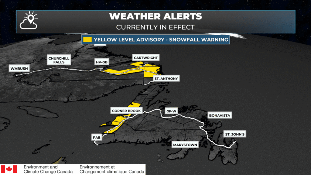
Yellow Level Snowfall Warnings from Environment Canada. These are in effect until this evening.
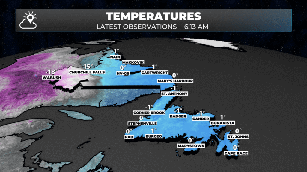
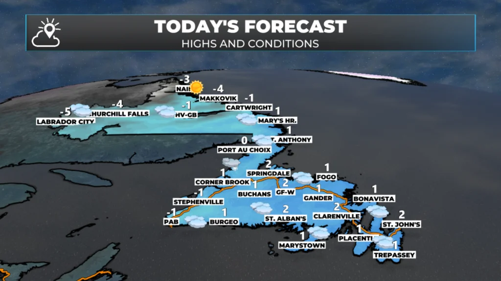
Today’s Forecast for NL
An area of low pressure is spinning in the North Atlantic and slowly drifting away from NL today. The low being in close proximity will keep snow on the go today for much of Labrador, along with Newfoundland’s West Coast and the Great Northern Peninsula. Travel conditons in and through these areas will remain very wintry at times today, even if there are no weather alerts in effect… I’m looking at you, Route 430 on the Great Northern Peninsula.
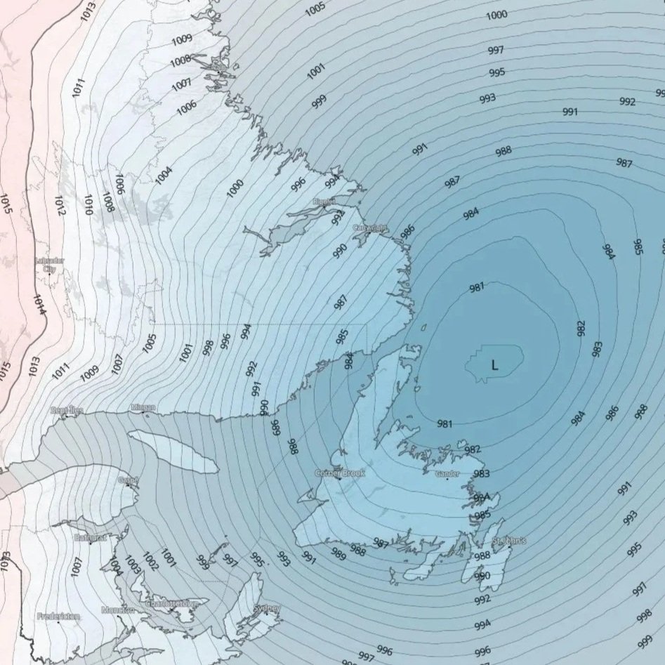
Sea level pressure chart as of this morning — Feb. 13, 2026 at 6:28 AM NST | Source: MeteoBlue
Areas outside of these regions, meaning essentially the rest of Newfoundland, will see scattered flurries today under mostly cloudy skies. Wind speeds will also be an issue in some areas, with gusts of up to about 70 km/h in exposed coastal locations. While not as windy as it’s been in the past, it will be noticeably breezy today.
Temperatures will peak near 0ºC on the Island, and for much of coastal Labrador, even western areas of the Big Land will have highs kind of warm today, as seen above, near -5ºC.
The Weekend Forecast
The area of low pressure drifts away overnight, setting the stage for a quieter weekend as the snow eases across Labrador and western Newfoundland. There will be a few flurries here and there, and there is a chance of some light snow over parts of the island Saturday afternoon and night, which could linger into Sunday. For now, this snow looks like it would be focused on the interior, but I’ll keep an eye on it. Either way, significant snowfall is not expected outside the higher terrain on the West Coast. Highs will remain freezing for the Island and a good chunk of Labrador.
I’ll have updates for you throughout the day — and a full look at the weekend and beyond this afternoon.
📱 Get the Sheerr Weather App in the Apple App Store and Google Play Store.
🗺️ Check out the Map Room to see all the latest weather observations for the Province.
🎥 Check out the Provincial Highway Cams to see 👀 what’s going on around our highways and
Thank you and have a great weekend.
Thank you Eddie!
Good morning Eddie, thanks for weather update.
Thank You Eddie, for such detailed forecast! I am now an old man 82 years old, and how I know, how much your forecast would have been appreciated back when I was a young fisherman
Thank you Eddie, for such detailed forecasts! I am 82 years old now, and how I wish we new what the weather was going to be like when I was a young fisherman back in the 50’s and 60’s., as we do today! Many ships, and lives were lost due to the unknown they were facing! I often wonder why there are so many, so called, (smart Alex’s, NL. language) around today, that degrade your excellent Service! Keep up the good Work! I am sure there are many that really appreciate what you do!
Good morning Eddie, thanks for the update. Have a great day.