
Wednesday Morning’s Weather Briefing — March 4, 2026
This video shows what we can expect across NL for today — March 4, 2026
Good Wednesday Morning!
Here are today’s weather highlights:
Schools in the Metro St. John’s area will be dismissing 2 hours early today due to the expected snowfall.
Snow arrives this morning across much of the Island and will end later this afternoon or evening.
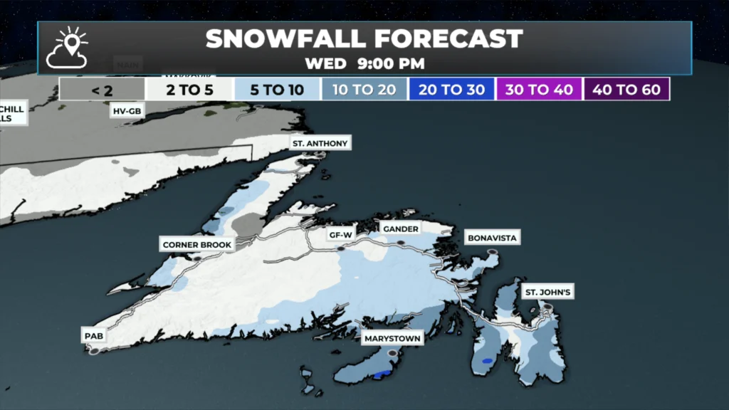
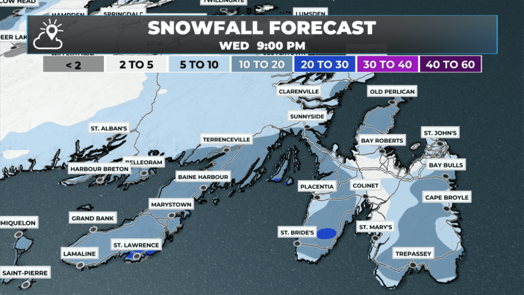
Expect 5 to 10 cm across much of Newfoundland today, with up to 15 cm possible over the Burin, Avalon, Bonavista Peninsula and around Clarenville, Terra Nova and the southwest part of Bonavista Bay.
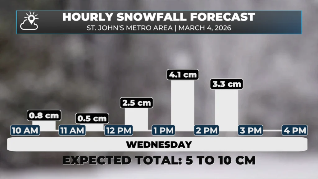
Snowfall rates will peak at 2 to 4 cm per hour late this morning and early this afternoon.
The Avalon and Burin Peninsulas may see snow change to rain shortly before it ends.
Arctic air returns tonight, setting the stage for a very cold Thursday across the region. Extreme Cold Warnings are in effect for wind chills of -30ºC to -50ºC.
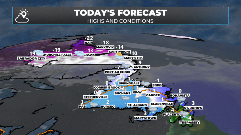
NL’s forecast for today – March 4, 2026
The Forecast
Snow will arrive over much of the Island this morning (if it hasn’t already), setting the stage for a few hours of difficult travel due to slippery roads and reduced visibility. Metro schools are dismissing 2 hours early today due to the incoming snow. The snowfall rates will peak at 2 to 4 cm per hour over the eastern three peninsulas and the Clarenville area later this morning or early afternoon. The snow will end for all areas this afternoon or early afternoon, and it will change to rain shortly before ending this afternoon on the Avlaon Peninsula. The images below show the expected amounts across Newfoundland today and when the rates will peak in the metro area.
The snow will be wet today as temperatures over much of the Island peak near freezing… however arctic air moves in tonight, setting the stage for some bitterly cold temperatures across the Province into Thursday and Friday. Extreme Cold Warnings are in effect for wind chills between -30ºC and -50ºC. The coldest of those readings will be found in northern and western Labrador. Temperatures begin to recover somewhat on Friday.
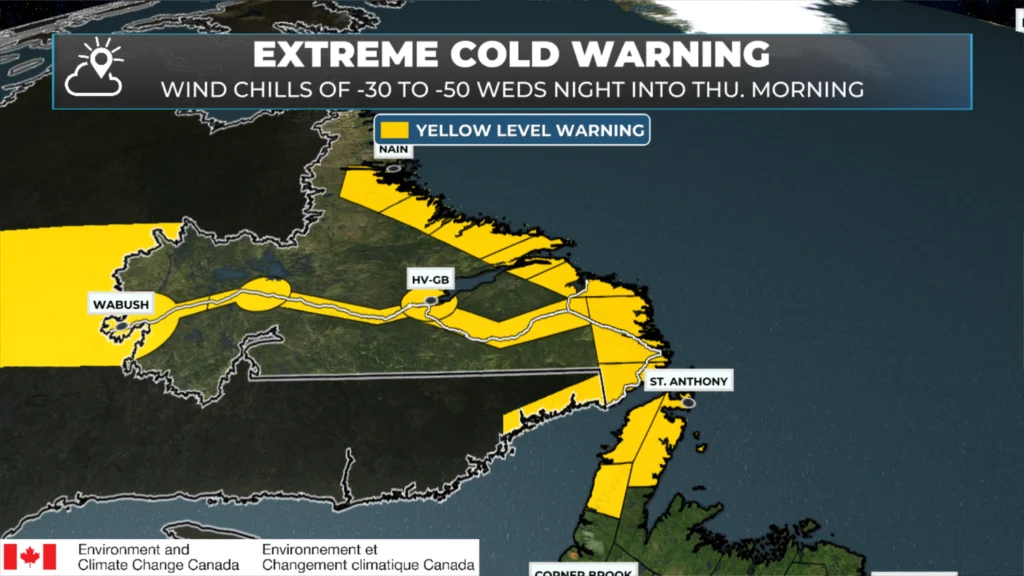
Extreme Cold Warning goes into effect tonight and continues into Thursday (March 4 and 5, 2026)
Once we are through today and the arctic air, the weather across NL does look milder and kind of quiet for a few days (in a row). That doesn’t mean it will be all sun and cloud… a few disturbances will work through but none look to be major at this time.
I’ll have updates for you throughout the day!
📱 Get the Sheerr Weather App in the Apple App Store and Google Play Store.
🗺️ Check out the Map Room to see all the latest weather observations for the Province.
🎥 Check out the Provincial Highway Cams to see 👀 what’s going on around our highways and
Good morning Eddie thanks so much for the update, have a great day
Good Wednesday morning ☕️Eddie!
Thank you for the update!…Enjoy your day!
Good morning Eddie,thanks for weather update.
Good morning, thanks for the update
Thanks Eddy for the update. Keep well.
You are a gem
Thank you Eddie. I always trust your forecast. Have a good day
Thanks again Eddy for the weather report. Weather it’s good or bad I trust what you forecast for us and prepare us for what’s to come.
Snow started in Hermitage around 8am. It’s now 11:30 and we have about 10cm. It is still snowing heavily. Looks like we are going to get a real dumping.