
Tuesday Morning’s Weather Update — March 10, 2026
Good Tuesday Morning!
Here are today’s weather highlights:
An area of low pressure will track through the southern third of Labrador this morning, which will bring some rain and snow to the Big Land during the first half of the day, which ends this afternoon.
The low will generate some wind, and a WIND WARNING (YELLOW LEVEL) is in effect for the Northern Peninsula until this afternoon for gusts to 100 km/h from the southwest.
There may be a few flurries along the southwest coast this afternoon
Wednesdsay is quiet and breezy
Next strom arrives Thursday and Winter Storm Watches are in effect for much of the Island ahead of it, along with Special Weather Statements.
Today’s Forecast
An area of low pressure will track through southern Labrador this morning, bringing some rain and snow to the southeast corner of the Big Land. On top of that, as this system departs, it will generate some gusty winds along the coast of Labrador and more on the Northern Peninsula. Gusts will be as high as 100 km/h at times this morning into the early afternoon on the GNP before they ease later today.
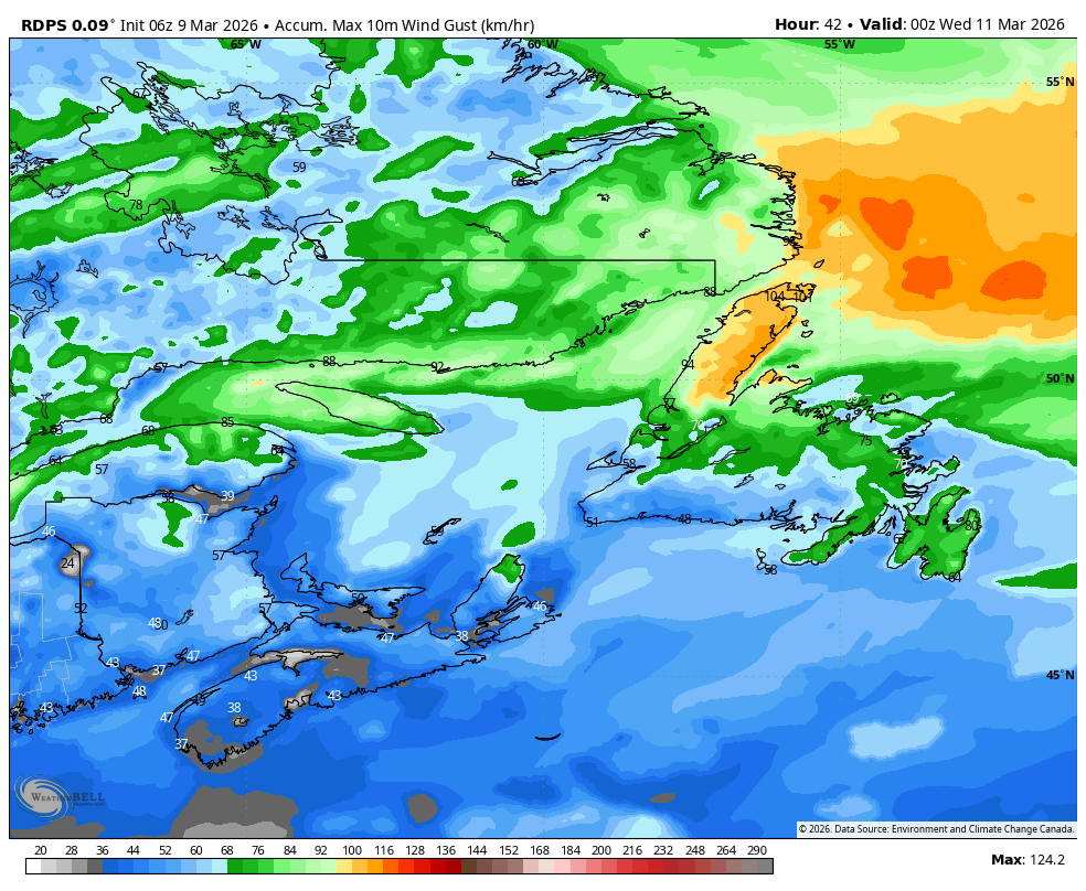
The expected peak wind gusts tomorrow – March 10, 2026
Outside of the rain and snow in the Big Land this morning, and the breezy conditions on the GNP, the weather across NL looks fairly unimpressive from today through tomorrow. Expect a fair bit of sun and cloud, with perhaps a few flurries along and near the west coast later today and this evening.
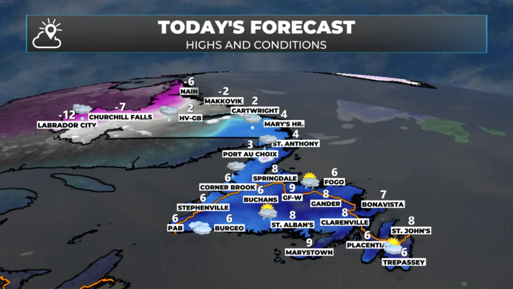
Wednesday will be quiet as well… however, Thursday will not be. Another low will move in, and this will bring a period of snow, ice, and eventually rain to much of the Island and mostly snow in Labrador. Ahead of this, Environment Canada has issued the following alerts:
❄️ Winter Storm Watch — The following areas are under an active winter storm watch, meaning conditions are expected to develop that could bring significant snowfall, blowing snow, or a mix of winter precipitation:
Potential snowfall: 15 to 25 cm, except 35 cm or more over higher terrain along the west coast.
Potential freezing rain duration: 6 to 8 hours.
Potential freezing rain amounts: 5 to 15 mm.
Bay of Exploits
Bay St. George
Buchans and the Interior
Corner Brook
Deer Lake – Humber Valley
Grand Falls-Windsor
Green Bay – White Bay
Gros Morne
Northern Peninsula East
Parson’s Pond – Hawke’s Bay
Port Saunders and the Straits
📋 Special Weather Statements — The following areas have special weather statements in effect — conditions are noteworthy but currently below warning or watch thresholds:
Potential freezing rain duration: near 4 hours. Potential freezing rain amounts: 2 to 5 mm.
Bonavista North
Gander
Bonavista Peninsula
Clarenville
Terra Nova
Potential snowfall: 5 to 10 cm, except less over the Burin Peninsula. Potential rainfall: 25 to 50 mm.
Burgeo–Ramea · Burin Peninsula
Channel–Port aux Basques
Connaigre
Burin Peninsula
I’ll have my next forecast posted later today or this evening.
📱 Get the Sheerr Weather App in the Apple App Store and Google Play Store.
🗺️ Check out the Map Room to see all the latest weather observations for the Province.
🎥 Check out the Provincial Highway Cams to see 👀 what’s going on around our highways and
Good Morning Eddie!
Forecast for Thursdays system sounds good for Avalon North area,
as it’s not mentioned at all, unless I missed it. Enjoy your day!
Good morning Eddie, thanks for the weather update.
Mornin Eddie! I’m hoping there’s no weather on this end for Thursday! Got an appointment in town! Love your weather updates! Have a great day !
Thank you sir, for all your work!