
Tuesday Morning’s Weather Briefing – April 7, 2026

Forecasts, alerts & live weather for Newfoundland and Labrador
Generally quiet weather across the Province today, with a few flurries.
Expect a mix of sun and cloud.
Highs reach near freezing over the Avalon, and remain a bit below to the west and into the minus single digits and teens in Labrador.
A fast-moving low will bring another round of snow to the Avalon and some areas of eastern Newfoundland tomorrow afternoon, with amounts of 5 to 10 cm.
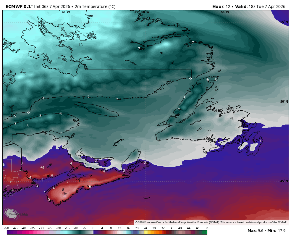
Today is a bit of a breather across Newfoundland and Labrador, and you can see that reflected in the lack of meaningful precipitation signals through much of the day. We’re sitting under relatively quiet conditions, so while there are a few flurries around, especially in typical upslope and coastal areas of the west coast, most places are just seeing a mix of sun and cloud. Temperatures are pretty seasonable for early April — near the freezing mark on the Avalon, a touch colder as you head west, and still firmly in winter mode across Labrador where highs are stuck in the minus single digits and teens.
That quiet stretch doesn’t last long, though. The next system is already lining up to the south and will move in fairly quickly tomorrow afternoon. It’s not a major storm, but it’s organized enough to bring another round of accumulating snow, mainly to the Avalon and parts of eastern Newfoundland. The setup is classic for this time of year — a fast-moving low tracking nearby with just enough moisture and cold air in place to efficiently produce snowfall without dragging things out for too long.
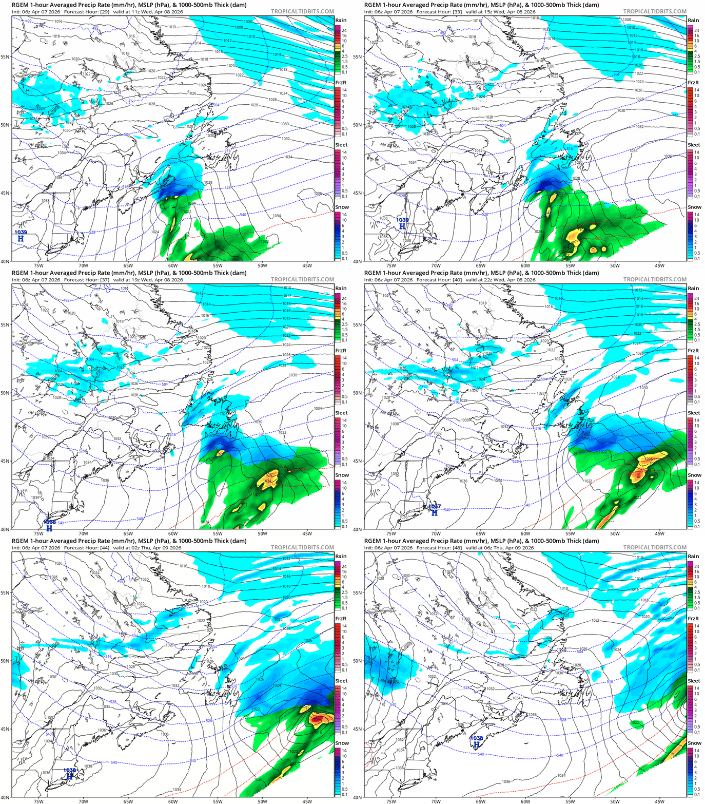
Timing-wise, this looks like it ramps up through the afternoon and into the evening, which is worth noting if you’ve got travel plans. The snow should come down at a decent clip for a few hours, and while totals are generally in that 5 to 10 cm range, there could be some locally higher amounts where bands briefly set up. With temperatures hovering near freezing, especially closer to the coast, this will likely be on the heavier, wetter side — so it’ll accumulate quickly on untreated surfaces.
Beyond that, the pattern doesn’t really shut off. You can see hints of additional systems and unsettled conditions lingering into the weekend and early next week. Nothing screaming major storm at this point, but enough activity that we’re not transitioning into a quiet spring pattern just yet. It’s more of the same — brief breaks followed by quick-hitting systems — which is pretty typical for April around here.
📱 Get the Sheerr Weather App in the Apple App Store and Google Play Store.
🗺️ Check out the Map Room to see all the latest weather observations for the Province.
🎥 Check out the Provincial Highway Cams to see 👀 what’s going on around our highways and
By using this website, you agree to our use of cookies. We use cookies to provide you with a great experience and to help our website run effectively. Privacy Policy
Good afternoon Eddie thanks for updating us
We do need spring.
Thanks Eddie, for weather update
Eddie where is the forecast for today, Thursday? Are you in Florida on vacation?