
Friday Morning’s Weather Briefing — April 10, 2026
Good Friday morning!
Here are today’s weather highlights:
A fast-moving low will move through northern Labrador and will bring areas of rain and snow showers to the Big Land throughout the day.
This same setup will allow some warmer air to push into Newfoundland and southeast Labrador, leading to widespread temperatures above freezing.
It will be a little breezy for many areas today, especially in the Strait of Belle Isle, with gusty southwesterlies.
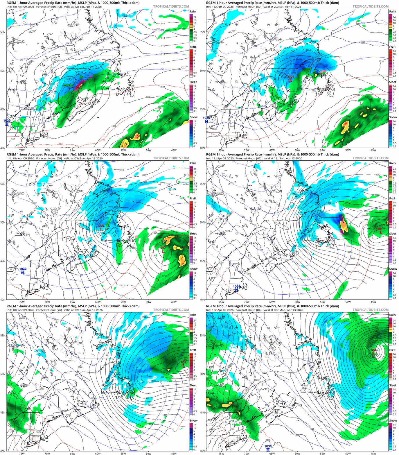
On the heels of today’s system, another low will develop Saturday and bring a late-season winter storm to southeastern Labrador and parts of western Newfoundland and the GNP. Expect wintry travel in this area from Saturday afternoon through Sunday.
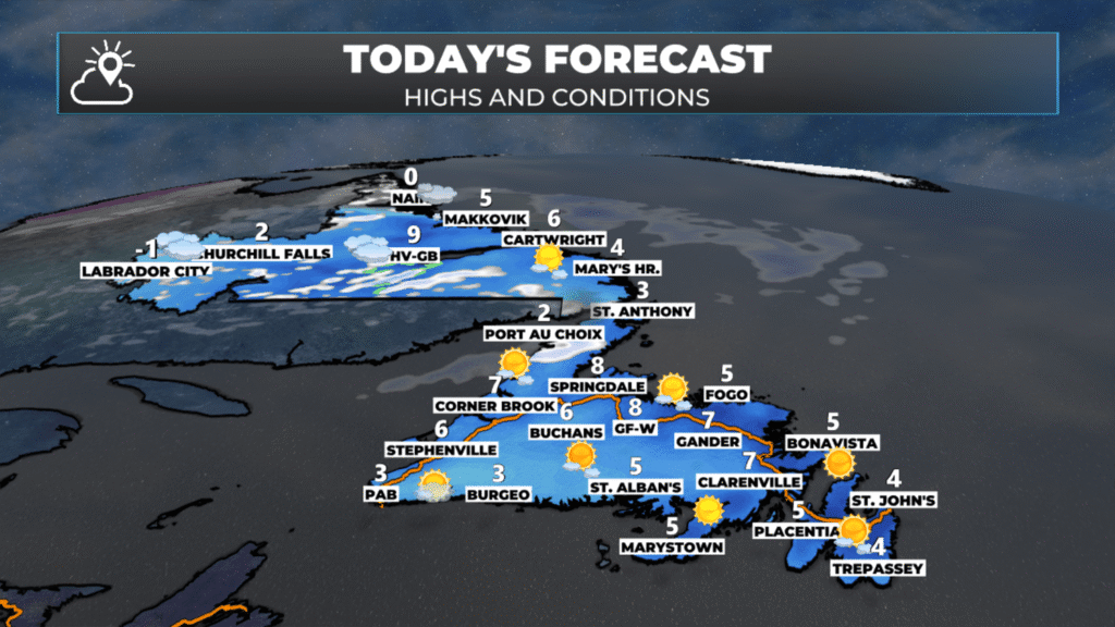
A fast-moving low-pressure system will track through northern Labrador today, bringing scattered rain and snow showers to the Big Land throughout Thursday. This system isn’t particularly strong, but it will be enough to keep conditions unsettled across Labrador with periods of precipitation likely from Happy Valley-Goose Bay northward through the day.
Warmth Returns to the Island
The good news? That same weather setup is ushering in milder air from the southwest. Temperatures across Newfoundland and southeastern Labrador will climb above freezing today — a welcome change after the recent chilly stretch. We’re looking at highs ranging from 2°C to 7°C across most of the Island, with the warmest readings expected along the south coast and Avalon Peninsula. Even southeast Labrador should see temperatures nudge above the freezing mark this afternoon.
This mild push is courtesy of southwesterly flow ahead of today’s northern low, which is pulling warmer air up from the south. It’s a typical mid-April setup: we’re in that shoulder season where temperatures can swing dramatically depending on which side of a low pressure system you’re on.
Breezy Conditions, Especially in the Strait
Along with the milder temperatures, expect a bit of wind today. Southwesterlies will gust up across many areas, with the strongest winds focused in the Strait of Belle Isle. Coastal areas of the Northern Peninsula and southeastern Labrador could see gusts reaching 60-70 km/h at times. Inland areas will be breezy but not quite as gusty, with sustained winds of 20-30 km/h and occasional higher gusts.

Good Morng Eddie! Finally, the temp is going up a little, but will probably be short lived. It gives one a boost to hear this. Could spring be on the way!!!?
Thanks for update, much appreciated.
Thanks Eddie Sheerr have a great weekend 👍👍